Braga geodata
Braga is a seat of a first-order administrative division; located in Portugal in Europe/Lisbon (GMT+1) time zone. With population of 121,394 people, there are 3 cities with bigger population in this country. Compared to other cities in Portugal, 94.7% of cities are located further ↓South; 61.1% of cities are located further ←West and 67.4% of cities have lower elevation than Braga. Note1


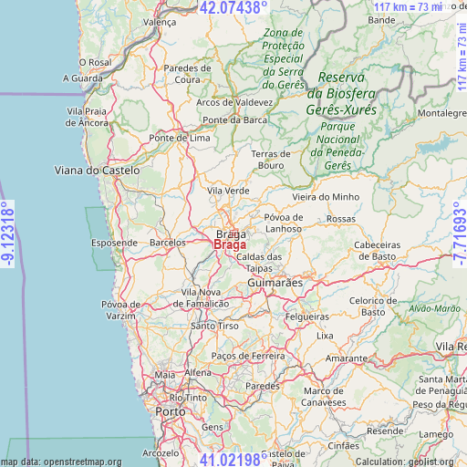
Braga GPS coordinates[2]
41° 33' 1.152" North, 8° 25' 12.18" West
| Map corner | latitude | longitude |
|---|---|---|
| Upper-left | 42.07438°, | -9.12318° |
| Center: | 41.55032°, | -8.42005° |
| Lower-right: | 41.02198°, | -7.71693° |
| Map W x H: | 117×117 km | = 72.7×72.7mi |
| max Lat: | 42.11337° ⇑5.3% North |
| Braga: | 41.55032° |
| min Lat: | ⇓94.7% South 32.6448° |
| min Long | Braga | max Long |
| -31.17847° | -8.42005° | -6.27308° |
| W 61.1%⇐ | ⇒38.9% E |
Elevation
Elevation of Braga is 188 m = 617 ft, and this is 11 m = 36 ft above average elevation for this country.
| Max E: |
1008 m = 3307 ft | 32.6% |
| Braga | 188 m 617 ft | |
| Avg. | 177 m = 581 ft | |
Min E: |
-128 m = -420 ft | 67.4% |
See also: Braga elevation on elevation.city.
Geographical zone
Braga is located in North temperate zone (between Tropic of Cancer and the Arctic Circle). Distance of this Northern Tropic circle is 2014 km =1251.4 mi to South.| Distance of | km | miles | from Braga |
|---|---|---|---|
| North Pole | 5387.1 | 3347.4 | to North |
| Arctic Circle | 2781.2 | 1728.2 | to North |
| Tropic Cancer | 2014 | 1251.4 | to South |
| Equator | 4620 | 2870.7 | to South |


Nearby cities:
15 places around Braga: (largest is in red/bold)
• Adaúfe
4.5 km =2.8 mi,  23°
23°
• Arcos
3.2 km =2 mi,  182°
182°
• Aveleda
5.1 km =3.2 mi,  230°
230°
• Esporões
4.5 km =2.8 mi, 177°
• Frossos
3.1 km =1.9 mi,  303°
303°
• Gondizalves
3.1 km =1.9 mi,  251°
251°
• Guisande
7.8 km =4.8 mi,  195°
195°
• Lago
7.9 km =4.9 mi,  4°
4°
• Lamas
5.4 km =3.4 mi,  192°
192°
• Merelim
5.5 km =3.4 mi,  316°
316°
• Prado
6.8 km =4.2 mi,  328°
328°
• Real
2.1 km =1.3 mi,  294°
294°
• Rendufe
8.8 km =5.5 mi,  6°
6°
• Semelhe
3.6 km =2.2 mi,  277°
277°
• Vilaça
6.4 km =4 mi,  235°
235°
Sources, notices
• [Note1] Compared only with cities in Portugal existing in our database
• [Src1] Map data: © OpenStreetMap contributors (CC-BY-SA)
• [Src2] Other city data from geonames.org with taken over terms of usage.
• [Src3] Geographical zone / Annual Mean Temperature by Robert A. Rohde @ Wikipedia
