Semelhe geodata
Semelhe (Braga) is a populated place; located in Portugal in Europe/Lisbon (GMT+1) time zone. With population of 11,700 people, there are 176 cities with bigger population in this country. Compared to other cities in Portugal, 94.9% of cities are located further ↓South; 57.8% of cities are located further ←West and 54.1% of cities have lower elevation than Semelhe. Note1


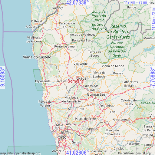
Semelhe GPS coordinates[2]
41° 33' 15.732" North, 8° 27' 46.116" West
| Map corner | latitude | longitude |
|---|---|---|
| Upper-left | 42.07839°, | -9.16593° |
| Center: | 41.55437°, | -8.46281° |
| Lower-right: | 41.02606°, | -7.75968° |
| Map W x H: | 117×117 km | = 72.7×72.7mi |
| max Lat: | 42.11337° ⇑5.1% North |
| Semelhe: | 41.55437° |
| min Lat: | ⇓94.9% South 32.6448° |
| min Long | Semelhe | max Long |
| -31.17847° | -8.46281° | -6.27308° |
| W 57.8%⇐ | ⇒42.2% E |
Elevation
Elevation of Semelhe is 126 m = 413 ft, and this is 51 m = 167 ft below average elevation for this country.
| Max E: |
1008 m = 3307 ft | 45.9% |
| Avg. | 177 m = 581 ft | |
| Semelhe | 126 m = 413 ft | |
Min E: |
-128 m = -420 ft | 54.1% |
See also: Portugal elevation on elevation.city.
Geographical zone
Semelhe is located in North temperate zone (between Tropic of Cancer and the Arctic Circle). Distance of this Northern Tropic circle is 2014.5 km =1251.8 mi to South.| Distance of | km | miles | from Semelhe |
|---|---|---|---|
| North Pole | 5386.6 | 3347.1 | to North |
| Arctic Circle | 2780.8 | 1727.9 | to North |
| Tropic Cancer | 2014.5 | 1251.8 | to South |
| Equator | 4620.4 | 2871 | to South |


Nearby cities:
15 places around Semelhe: (largest is in red/bold)
• Adaúfe
6.5 km =4 mi,  55°
55°
• Arcos
5 km =3.1 mi,  136°
136°
• Aveleda
3.7 km =2.3 mi,  185°
185°
• Braga
3.6 km =2.2 mi,  97°
97°
• Esporões
6.2 km =3.9 mi, 142°
• Frossos
1.6 km =1 mi,  36°
36°
• Gondizalves
1.5 km =0.9 mi,  157°
157°
• Guisande
8.1 km =5 mi,  169°
169°
• Lamas
6.2 km =3.9 mi, 157°
• Merelim
3.5 km =2.2 mi,  356°
356°
• Oliveira
8.5 km =5.3 mi,  183°
183°
• Prado
5.3 km =3.3 mi, 359°
• Real
1.7 km =1.1 mi,  74°
74°
• Tebosa
8.2 km =5.1 mi, 192°
• Vilaça
4.4 km =2.7 mi,  203°
203°
Sources, notices
• [Note1] Compared only with cities in Portugal existing in our database
• [Src1] Map data: © OpenStreetMap contributors (CC-BY-SA)
• [Src2] Other city data from geonames.org with taken over terms of usage.
• [Src3] Geographical zone / Annual Mean Temperature by Robert A. Rohde @ Wikipedia
