Galegos geodata
Galegos (Braga) is a populated place; located in Portugal in Europe/Lisbon (GMT+1) time zone. With population of 5,404 people, there are 399 cities with bigger population in this country. Compared to other cities in Portugal, 95.2% of cities are located further ↓South; 50.8% of cities are located further →East and 57.8% of cities have higher elevation than Galegos. Note1


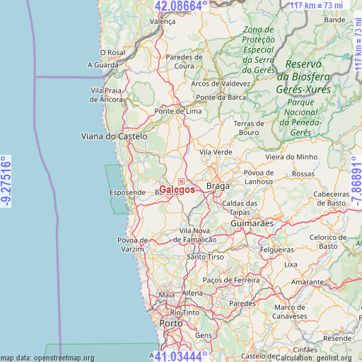
Galegos GPS coordinates[2]
41° 33' 45.648" North, 8° 34' 19.344" West
| Map corner | latitude | longitude |
|---|---|---|
| Upper-left | 42.08664°, | -9.27516° |
| Center: | 41.56268°, | -8.57204° |
| Lower-right: | 41.03444°, | -7.86891° |
| Map W x H: | 117×117 km | = 72.7×72.7mi |
| max Lat: | 42.11337° ⇑4.8% North |
| Galegos: | 41.56268° |
| min Lat: | ⇓95.2% South 32.6448° |
| min Long | Galegos | max Long |
| -31.17847° | -8.57204° | -6.27308° |
| W 49.2%⇐ | ⇒50.8% E |
Elevation
Elevation of Galegos is 85 m = 279 ft, and this is 92 m = 302 ft below average elevation for this country.
| Max E: |
1008 m = 3307 ft | 57.8% |
| Avg. | 177 m = 581 ft | |
| Galegos | 85 m = 279 ft | |
Min E: |
-128 m = -420 ft | 42.2% |
See also: Portugal elevation on elevation.city.
Geographical zone
Galegos is located in North temperate zone (between Tropic of Cancer and the Arctic Circle). Distance of this Northern Tropic circle is 2015.4 km =1252.3 mi to South.| Distance of | km | miles | from Galegos |
|---|---|---|---|
| North Pole | 5385.7 | 3346.5 | to North |
| Arctic Circle | 2779.8 | 1727.3 | to North |
| Tropic Cancer | 2015.4 | 1252.3 | to South |
| Equator | 4621.3 | 2871.5 | to South |


Nearby cities:
15 places around Galegos: (largest is in red/bold)
• Aveleda
9.9 km =6.2 mi,  117°
117°
• Barcelos
5.2 km =3.2 mi,  228°
228°
• Fornelos
10.1 km =6.3 mi,  240°
240°
• Frossos
10 km =6.2 mi,  87°
87°
• Gondizalves
10 km =6.2 mi,  103°
103°
• Mariz
9.1 km =5.7 mi,  245°
245°
• Merelim
9.2 km =5.7 mi,  73°
73°
• Perelhal
10.4 km =6.5 mi, 250°
• Prado
10.1 km =6.3 mi,  64°
64°
• Real
10.7 km =6.6 mi, 92°
• Semelhe
9.1 km =5.7 mi, 95°
• Tebosa
11.5 km =7.1 mi,  140°
140°
• Vila Frescainha
6.2 km =3.9 mi, 244°
• Vilaça
8.9 km =5.5 mi, 124°
• Várzea
5.4 km =3.4 mi,  190°
190°
Sources, notices
• [Note1] Compared only with cities in Portugal existing in our database
• [Src1] Map data: © OpenStreetMap contributors (CC-BY-SA)
• [Src2] Other city data from geonames.org with taken over terms of usage.
• [Src3] Geographical zone / Annual Mean Temperature by Robert A. Rohde @ Wikipedia
