Espinho geodata
Espinho (Aveiro) is a seat of a second-order administrative division; located in Portugal in Europe/Lisbon (GMT+0) time zone. With population of 32,786 people, there are 44 cities with bigger population in this country. Compared to other cities in Portugal, 70.7% of cities are located further ↓South; 57.9% of cities are located further →East and 88.3% of cities have higher elevation than Espinho. Note1


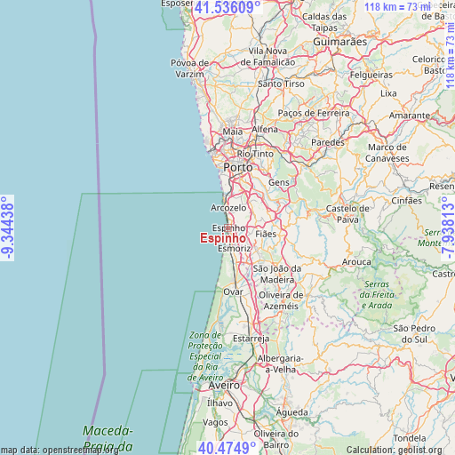
Espinho GPS coordinates[2]
41° 0' 27.468" North, 8° 38' 28.5" West
| Map corner | latitude | longitude |
|---|---|---|
| Upper-left | 41.53609°, | -9.34438° |
| Center: | 41.00763°, | -8.64125° |
| Lower-right: | 40.4749°, | -7.93813° |
| Map W x H: | 118×118 km | = 73.3×73.3mi |
| max Lat: | 42.11337° ⇑29.3% North |
| Espinho: | 41.00763° |
| min Lat: | ⇓70.7% South 32.6448° |
| min Long | Espinho | max Long |
| -31.17847° | -8.64125° | -6.27308° |
| W 42.1%⇐ | ⇒57.9% E |
Elevation
Elevation of Espinho is 19 m = 62 ft, and this is 158 m = 518 ft below average elevation for this country.
| Max E: |
1008 m = 3307 ft | 88.3% |
| Avg. | 177 m = 581 ft | |
| Espinho | 19 m = 62 ft | |
Min E: |
-128 m = -420 ft | 11.7% |
See also: Portugal elevation on elevation.city.
Geographical zone
Espinho is located in North temperate zone (between Tropic of Cancer and the Arctic Circle). Distance of this Northern Tropic circle is 1953.7 km =1214 mi to South.| Distance of | km | miles | from Espinho |
|---|---|---|---|
| North Pole | 5447.4 | 3384.9 | to North |
| Arctic Circle | 2841.6 | 1765.7 | to North |
| Tropic Cancer | 1953.7 | 1214 | to South |
| Equator | 4559.6 | 2833.2 | to South |


Nearby cities:
15 places around Espinho: (largest is in red/bold)
• Arcozelo
6.1 km =3.8 mi,  7°
7°
• Azenha
7.8 km =4.8 mi, 10°
• Cortegaça
6.7 km =4.2 mi,  165°
165°
• Esmoriz
5.7 km =3.5 mi, 168°
• Grijó
5.6 km =3.5 mi,  65°
65°
• Lamas
6.5 km =4 mi,  111°
111°
• Nogueira da Regedoura
4.1 km =2.5 mi,  93°
93°
• Paços de Brandão
6 km =3.7 mi,  126°
126°
• Rio Meão
7.7 km =4.8 mi,  136°
136°
• Sermonde
6.5 km =4 mi,  47°
47°
• Serzedo
5.3 km =3.3 mi,  23°
23°
• Silvalde
2.2 km =1.4 mi, 142°
• Souto
3 km =1.9 mi,  147°
147°
• São Félix da Marinha
3.5 km =2.2 mi,  26°
26°
• Vila Nova da Telha
7.1 km =4.4 mi,  359°
359°
Sources, notices
• [Note1] Compared only with cities in Portugal existing in our database
• [Src1] Map data: © OpenStreetMap contributors (CC-BY-SA)
• [Src2] Other city data from geonames.org with taken over terms of usage.
• [Src3] Geographical zone / Annual Mean Temperature by Robert A. Rohde @ Wikipedia
