Belver geodata
Belver (Bragança) is a populated place; located in Portugal in Europe/Lisbon (GMT+1) time zone. With population of 1,100 people, there are 737 cities with bigger population in this country. Compared to other cities in Portugal, 81.1% of cities are located further ↓South; 96.8% of cities are located further ←West and 98.8% of cities have lower elevation than Belver. Note1


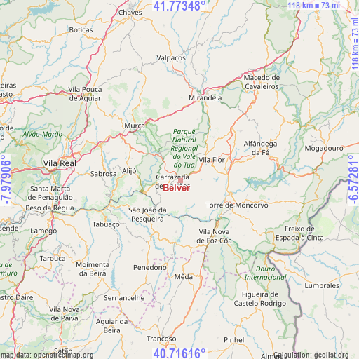
Belver GPS coordinates[2]
41° 14' 49.056" North, 7° 16' 33.384" West
| Map corner | latitude | longitude |
|---|---|---|
| Upper-left | 41.77348°, | -7.97906° |
| Center: | 41.24696°, | -7.27594° |
| Lower-right: | 40.71616°, | -6.57281° |
| Map W x H: | 117.6×117.6 km | = 73.1×73.1mi |
| max Lat: | 42.11337° ⇑18.9% North |
| Belver: | 41.24696° |
| min Lat: | ⇓81.1% South 32.6448° |
| min Long | Belver | max Long |
| -31.17847° | -7.27594° | -6.27308° |
| W 96.8%⇐ | ⇒3.2% E |
Elevation
Elevation of Belver is 762 m = 2500 ft, and this is 585 m = 1919 ft above average elevation for this country.
| Max E: |
1008 m = 3307 ft | 1.2% |
| Belver | 762 m 2500 ft | |
| Avg. | 177 m = 581 ft | |
Min E: |
-128 m = -420 ft | 98.8% |
See also: Portugal elevation on elevation.city.
Geographical zone
Belver is located in North temperate zone (between Tropic of Cancer and the Arctic Circle). Distance of this Northern Tropic circle is 1980.3 km =1230.5 mi to South.| Distance of | km | miles | from Belver |
|---|---|---|---|
| North Pole | 5420.8 | 3368.3 | to North |
| Arctic Circle | 2814.9 | 1749.1 | to North |
| Tropic Cancer | 1980.3 | 1230.5 | to South |
| Equator | 4586.2 | 2849.7 | to South |


Nearby cities:
15 places around Belver: (largest is in red/bold)
• Alijó
16.9 km =10.5 mi,  281°
281°
• Carrazeda de Anciães
2.7 km =1.7 mi,  259°
259°
• Custoias
16.2 km =10.1 mi,  193°
193°
• Ervedosa do Douro
18.8 km =11.7 mi,  241°
241°
• Favaios
19.3 km =12 mi, 277°
• Freixo de Numão
20.5 km =12.7 mi,  167°
167°
• Murça
23.1 km =14.4 mi,  319°
319°
• Pinhão
23.4 km =14.5 mi,  254°
254°
• Sabrosa
25.2 km =15.7 mi, 275°
• São João da Pesqueira
15.4 km =9.6 mi,  224°
224°
• Torre de Moncorvo
20.3 km =12.6 mi,  113°
113°
• Trevões
22.7 km =14.1 mi, 215°
• Vila Flor
12.3 km =7.6 mi,  55°
55°
• Vila Nova de Foz Côa
21.5 km =13.4 mi,  148°
148°
• Vilela
27.5 km =17.1 mi, 264°
Sources, notices
• [Note1] Compared only with cities in Portugal existing in our database
• [Src1] Map data: © OpenStreetMap contributors (CC-BY-SA)
• [Src2] Other city data from geonames.org with taken over terms of usage.
• [Src3] Geographical zone / Annual Mean Temperature by Robert A. Rohde @ Wikipedia
