Murça geodata
Murça (Vila Real) is a seat of a second-order administrative division; located in Portugal in Europe/Lisbon (GMT+1) time zone. In our database, there are 824 cities with bigger population. Compared to other cities in Portugal, 88.3% of cities are located further ↓South; 93.7% of cities are located further ←West and 90.8% of cities have lower elevation than Murça. Note1


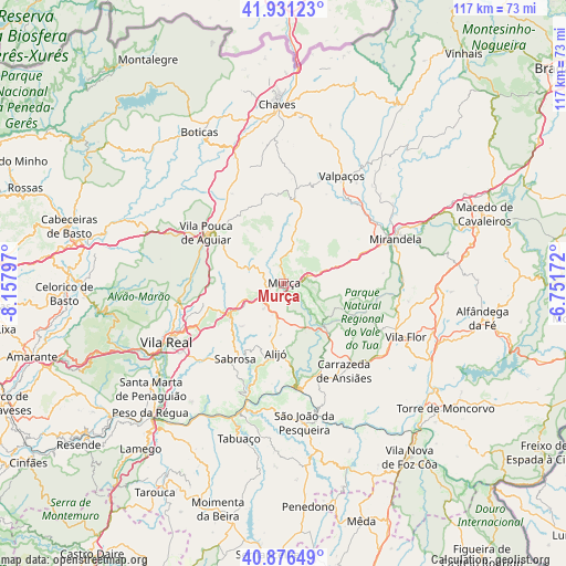
Murça GPS coordinates[2]
41° 24' 21.6" North, 7° 27' 17.46" West
| Map corner | latitude | longitude |
|---|---|---|
| Upper-left | 41.93123°, | -8.15797° |
| Center: | 41.406°, | -7.45485° |
| Lower-right: | 40.87649°, | -6.75172° |
| Map W x H: | 117.3×117.3 km | = 72.9×72.9mi |
| max Lat: | 42.11337° ⇑11.7% North |
| Murça: | 41.406° |
| min Lat: | ⇓88.3% South 32.6448° |
| min Long | Murça | max Long |
| -31.17847° | -7.45485° | -6.27308° |
| W 93.7%⇐ | ⇒6.3% E |
Elevation
Elevation of Murça is 488 m = 1601 ft, and this is 311 m = 1020 ft above average elevation for this country.
| Max E: |
1008 m = 3307 ft | 9.2% |
| Murça | 488 m 1601 ft | |
| Avg. | 177 m = 581 ft | |
Min E: |
-128 m = -420 ft | 90.8% |
See also: Portugal elevation on elevation.city.
Geographical zone
Murça is located in North temperate zone (between Tropic of Cancer and the Arctic Circle). Distance of this Northern Tropic circle is 1998 km =1241.5 mi to South.| Distance of | km | miles | from Murça |
|---|---|---|---|
| North Pole | 5403.1 | 3357.3 | to North |
| Arctic Circle | 2797.3 | 1738.2 | to North |
| Tropic Cancer | 1998 | 1241.5 | to South |
| Equator | 4603.9 | 2860.7 | to South |


Nearby cities:
15 places around Murça: (largest is in red/bold)
• Alijó
14.5 km =9 mi,  186°
186°
• Belver
23.1 km =14.4 mi,  139°
139°
• Carrazeda de Anciães
22 km =13.7 mi,  145°
145°
• Ervedosa do Douro
26.7 km =16.6 mi,  183°
183°
• Favaios
15.8 km =9.8 mi,  195°
195°
• Mirandela
24.1 km =15 mi,  67°
67°
• Pinhão
25.1 km =15.6 mi, 197°
• Ribeira de Pena
31.7 km =19.7 mi,  293°
293°
• Sabrosa
18.5 km =11.5 mi,  213°
213°
• São João da Pesqueira
29 km =18 mi,  171°
171°
• Valpaços
25.4 km =15.8 mi,  28°
28°
• Vila Flor
27.3 km =17 mi,  113°
113°
• Vila Pouca de Aguiar
18.9 km =11.7 mi,  303°
303°
• Vila Real
26.8 km =16.7 mi,  244°
244°
• Vilela
23.6 km =14.7 mi, 211°
Sources, notices
• [Note1] Compared only with cities in Portugal existing in our database
• [Src1] Map data: © OpenStreetMap contributors (CC-BY-SA)
• [Src2] Other city data from geonames.org with taken over terms of usage.
• [Src3] Geographical zone / Annual Mean Temperature by Robert A. Rohde @ Wikipedia
