Mbuyapey geodata
Mbuyapey (Paraguarí) is a populated place; located in Paraguay in America/Asuncion (GMT-4) time zone. With population of 2,201 people, there are 105 cities with bigger population in this country. Compared to other cities in Paraguay, 74.1% of cities are located further ↑North; 52.5% of cities are located further →East and 56.8% of cities have higher elevation than Mbuyapey. Note1


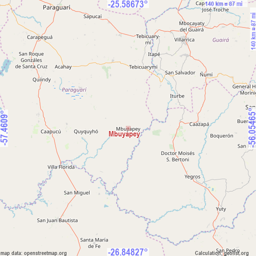
Mbuyapey GPS coordinates[2]
26° 13' 9.156" South, 56° 45' 27.972" West
| Map corner | latitude | longitude |
|---|---|---|
| Upper-left | -25.58673°, | -57.4609° |
| Center: | -26.21921°, | -56.75777° |
| Lower-right: | -26.84827°, | -56.05465° |
| Map W x H: | 140.3×140.3 km | = 87.2×87.2mi |
| max Lat: | -19.91667° ⇑74.1% North |
| Mbuyapey: | -26.21921° |
| min Lat: | ⇓25.9% South -27.38662° |
| min Long | Mbuyapey | max Long |
| -60.78333° | -56.75777° | -54.30694° |
| W 47.5%⇐ | ⇒52.5% E |
Elevation
Elevation of Mbuyapey is 132 m = 433 ft, and this is 37.7 m = 124 ft below average elevation for this country.
| Max E: |
658 m = 2159 ft | 56.8% |
| Avg. | 169.7 m = 557 ft | |
| Mbuyapey | 132 m = 433 ft | |
Min E: |
46 m = 151 ft | 43.2% |
See also: Paraguay elevation on elevation.city.
Geographical zone
Mbuyapey is located in South temperate zone (between Tropic of Capricorn and the Antarctic Circle). Distance of this Southern Tropic circle is 309.4 km =192.3 mi to North.| Distance of | km | miles | from Mbuyapey |
|---|---|---|---|
| Equator | 2915.3 | 1811.5 | to North |
| Tropic Capricorn | 309.4 | 192.3 | to North |
| Antarctic Circle | 4485.9 | 2787.4 | to South |
| South Pole | 7091.8 | 4406.6 | to South |


Nearby cities:
15 places around Mbuyapey: (largest is in red/bold)
• Acahay
51.6 km =32.1 mi,  310°
310°
• Caapucú
42.4 km =26.3 mi,  267°
267°
• Caazapá
39 km =24.2 mi,  86°
86°
• Coronel Martínez
53.1 km =33 mi,  15°
15°
• Itapé
43.3 km =26.9 mi, 19°
• Iturbe
32.8 km =20.4 mi,  56°
56°
• La Colmena
37.9 km =23.5 mi,  347°
347°
• Maciel
28.7 km =17.8 mi,  81°
81°
• Quyquyó
22.6 km =14 mi, 266°
• San Miguel
42.7 km =26.5 mi,  223°
223°
• Villa Florida
43.1 km =26.8 mi,  244°
244°
• Ybycuí
36.9 km =22.9 mi, 307°
• Ybytymi
51.5 km =32 mi,  355°
355°
• Yegros
43.9 km =27.3 mi,  125°
125°
• Ñumi
52.2 km =32.4 mi, 55°
Sources, notices
• [Note1] Compared only with cities in Paraguay existing in our database
• [Src1] Map data: © OpenStreetMap contributors (CC-BY-SA)
• [Src2] Other city data from geonames.org with taken over terms of usage.
• [Src3] Geographical zone / Annual Mean Temperature by Robert A. Rohde @ Wikipedia
