Ñacunday geodata
Ñacunday (Alto Paraná) is a populated place; located in Paraguay in America/Asuncion (GMT-4) time zone. With population of 912 people, there are 142 cities with bigger population in this country. Compared to other cities in Paraguay, 69.8% of cities are located further ↑North; 95.1% of cities are located further ←West and 63% of cities have lower elevation than Ñacunday. Note1


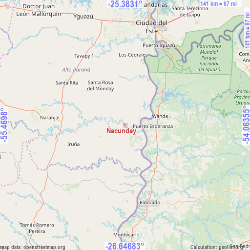
Ñacunday GPS coordinates[2]
26° 1' 0.012" South, 54° 46' 0.012" West
| Map corner | latitude | longitude |
|---|---|---|
| Upper-left | -25.3831°, | -55.4698° |
| Center: | -26.01667°, | -54.76667° |
| Lower-right: | -26.64683°, | -54.06355° |
| Map W x H: | 140.5×140.5 km | = 87.3×87.3mi |
| max Lat: | -19.91667° ⇑69.8% North |
| Ñacunday: | -26.01667° |
| min Lat: | ⇓30.2% South -27.38662° |
| min Long | Ñacunday | max Long |
| -60.78333° | -54.76667° | -54.30694° |
| W 95.1%⇐ | ⇒4.9% E |
Elevation
Elevation of Ñacunday is 168 m = 551 ft, and this is 1.7 m = 6 ft below average elevation for this country.
| Max E: |
658 m = 2159 ft | 37% |
| Avg. | 169.7 m = 557 ft | |
| Ñacunday | 168 m = 551 ft | |
Min E: |
46 m = 151 ft | 63% |
See also: Paraguay elevation on elevation.city.
Geographical zone
Ñacunday is located in South temperate zone (between Tropic of Capricorn and the Antarctic Circle). Distance of this Southern Tropic circle is 286.9 km =178.3 mi to North.| Distance of | km | miles | from Ñacunday |
|---|---|---|---|
| Equator | 2892.8 | 1797.5 | to North |
| Tropic Capricorn | 286.9 | 178.3 | to North |
| Antarctic Circle | 4508.4 | 2801.4 | to South |
| South Pole | 7114.3 | 4420.6 | to South |


Nearby cities:
15 places around Ñacunday: (largest is in red/bold)
• Alto Verá
106.9 km =66.4 mi,  233°
233°
• Arquitecto Tomás Romero Pereira
70.8 km =44 mi,  222°
222°
• Cedrales
40.3 km =25 mi,  6°
6°
• Ciudad del Este
58.5 km =36.4 mi,  15°
15°
• Colonia Carlos Antonio López
42.5 km =26.4 mi,  178°
178°
• Colonia San Lorenzo
53.1 km =33 mi, 183°
• Doctor Juan León Mallorquín
81.4 km =50.6 mi,  323°
323°
• Edelira
97.8 km =60.8 mi,  211°
211°
• Itapuá Poty
102.6 km =63.8 mi, 232°
• Naranjal
42 km =26.1 mi,  277°
277°
• Natalio
90.2 km =56 mi,  204°
204°
• Presidente Franco
52.7 km =32.7 mi, 17°
• Puerto Mayor Otaño
43.1 km =26.8 mi,  171°
171°
• Santa Rita
39.7 km =24.7 mi,  310°
310°
• Yguazú
66 km =41 mi,  339°
339°
Sources, notices
• [Note1] Compared only with cities in Paraguay existing in our database
• [Src1] Map data: © OpenStreetMap contributors (CC-BY-SA)
• [Src2] Other city data from geonames.org with taken over terms of usage.
• [Src3] Geographical zone / Annual Mean Temperature by Robert A. Rohde @ Wikipedia
