Naranjal geodata
Naranjal (Alto Paraná) is a populated place; located in Paraguay in America/Asuncion (GMT-4) time zone. With population of 2,151 people, there are 106 cities with bigger population in this country. Compared to other cities in Paraguay, 67.3% of cities are located further ↑North; 88.9% of cities are located further ←West and 87% of cities have lower elevation than Naranjal. Note1


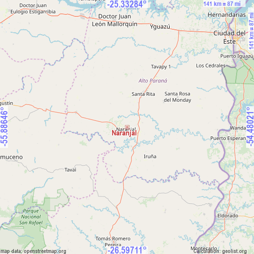
Naranjal GPS coordinates[2]
25° 58' 0.012" South, 55° 10' 59.988" West
| Map corner | latitude | longitude |
|---|---|---|
| Upper-left | -25.33284°, | -55.88646° |
| Center: | -25.96667°, | -55.18333° |
| Lower-right: | -26.59711°, | -54.48021° |
| Map W x H: | 140.6×140.6 km | = 87.4×87.4mi |
| max Lat: | -19.91667° ⇑67.3% North |
| Naranjal: | -25.96667° |
| min Lat: | ⇓32.7% South -27.38662° |
| min Long | Naranjal | max Long |
| -60.78333° | -55.18333° | -54.30694° |
| W 88.9%⇐ | ⇒11.1% E |
Elevation
Elevation of Naranjal is 273 m = 896 ft, and this is 103.3 m = 339 ft above average elevation for this country.
| Max E: |
658 m = 2159 ft | 13% |
| Naranjal | 273 m 896 ft | |
| Avg. | 169.7 m = 557 ft | |
Min E: |
46 m = 151 ft | 87% |
See also: Paraguay elevation on elevation.city.
Geographical zone
Naranjal is located in South temperate zone (between Tropic of Capricorn and the Antarctic Circle). Distance of this Southern Tropic circle is 281.3 km =174.8 mi to North.| Distance of | km | miles | from Naranjal |
|---|---|---|---|
| Equator | 2887.2 | 1794 | to North |
| Tropic Capricorn | 281.3 | 174.8 | to North |
| Antarctic Circle | 4514 | 2804.9 | to South |
| South Pole | 7119.8 | 4424 | to South |


Nearby cities:
15 places around Naranjal: (largest is in red/bold)
• Abaí
75.3 km =46.8 mi,  264°
264°
• Arquitecto Tomás Romero Pereira
57.8 km =35.9 mi,  186°
186°
• Cedrales
57.6 km =35.8 mi,  53°
53°
• Ciudad del Este
76.6 km =47.6 mi, 48°
• Colonia Carlos Antonio López
64.2 km =39.9 mi,  138°
138°
• Colonia San Lorenzo
69.9 km =43.4 mi,  146°
146°
• Doctor Juan León Mallorquín
60 km =37.3 mi,  353°
353°
• General Higinio Morínigo
73.3 km =45.5 mi,  271°
271°
• Itapuá Poty
79 km =49.1 mi,  210°
210°
• Presidente Franco
72.7 km =45.2 mi, 51°
• Puerto Mayor Otaño
68.2 km =42.4 mi,  134°
134°
• San Juan Nepomuceno
77.2 km =48 mi, 257°
• Santa Rita
23.5 km =14.6 mi,  29°
29°
• Yguazú
59.1 km =36.7 mi,  18°
18°
• Ñacunday
42 km =26.1 mi,  97°
97°
Sources, notices
• [Note1] Compared only with cities in Paraguay existing in our database
• [Src1] Map data: © OpenStreetMap contributors (CC-BY-SA)
• [Src2] Other city data from geonames.org with taken over terms of usage.
• [Src3] Geographical zone / Annual Mean Temperature by Robert A. Rohde @ Wikipedia
