Arquitecto Tomás Romero Pereira geodata
Arquitecto Tomás Romero Pereira (Itapúa) is a populated place; located in Paraguay in America/Asuncion (GMT-4) time zone. With population of 5,533 people, there are 56 cities with bigger population in this country. Compared to other cities in Paraguay, 78.4% of cities are located further ↑North; 88.3% of cities are located further ←West and 93.8% of cities have lower elevation than Arquitecto Tomás Romero Pereira. Note1
Current local time in Arquitecto Tomás Romero Pereira:
04:28 PM, ThursdayDifference from your time zone: hours


Arquitecto Tomás Romero Pereira GPS coordinates[2]
26° 28' 59.988" South, 55° 15' 0" West
| Map corner | latitude | longitude |
|---|---|---|
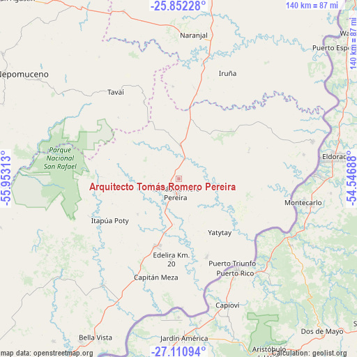
| Upper-left | -25.85228°, | -55.95313° |
| Center: | -26.48333°, | -55.25° |
| Lower-right: | -27.11094°, | -54.54688° |
| Map W x H: | 139.9×140 km | = 86.9×87mi |
| max Lat: | -19.91667° ⇑78.4% North |
| Arquitecto Tomás Romero Pereira: | -26.48333° |
| min Lat: | ⇓21.6% South -27.38662° |
| min Long | Arquitecto Tom� | max Long |
| -60.78333° | -55.25° | -54.30694° |
| W 88.3%⇐ | ⇒11.7% E |
Elevation
Elevation of Arquitecto Tomás Romero Pereira is 333 m = 1093 ft, and this is 163.3 m = 536 ft above average elevation for this country.
| Max E: |
658 m = 2159 ft | 6.2% |
| Arquitecto Tomás Romero Pereira | 333 m 1093 ft | |
| Avg. | 169.7 m = 557 ft | |
Min E: |
46 m = 151 ft | 93.8% |
See also: Paraguay elevation on elevation.city.
Geographical zone
Arquitecto Tomás Romero Pereira is located in South temperate zone (between Tropic of Capricorn and the Antarctic Circle). Distance of this Southern Tropic circle is 338.8 km =210.5 mi to North.| Distance of | km | miles | from Arquitecto Tomás Romero Pereira |
|---|---|---|---|
| Equator | 2944.7 | 1829.8 | to North |
| Tropic Capricorn | 338.8 | 210.5 | to North |
| Antarctic Circle | 4456.5 | 2769.1 | to South |
| South Pole | 7062.4 | 4388.4 | to South |


Nearby cities:
15 places around Arquitecto Tomás Romero Pereira: (largest is in red/bold)
• Alto Verá
39.7 km =24.7 mi,  253°
253°
• Bella Vista
69.7 km =43.3 mi,  205°
205°
• Capitán Meza
67.1 km =41.7 mi, 207°
• Colonia Carlos Antonio López
50 km =31.1 mi,  79°
79°
• Colonia San Lorenzo
44.8 km =27.8 mi,  91°
91°
• Edelira
31.7 km =19.7 mi,  185°
185°
• Hohenau
76.3 km =47.4 mi, 210°
• Itapuá Poty
34.7 km =21.6 mi, 251°
• Naranjal
57.8 km =35.9 mi,  6°
6°
• Natalio
32.4 km =20.1 mi,  159°
159°
• Obligado
72 km =44.7 mi, 211°
• Pirapó
51 km =31.7 mi, 214°
• Puerto Mayor Otaño
55.5 km =34.5 mi, 80°
• Santa Rita
80 km =49.7 mi, 13°
• Ñacunday
70.8 km =44 mi,  42°
42°
Sources, notices
• [Note1] Compared only with cities in Paraguay existing in our database
• [Src1] Map data: © OpenStreetMap contributors (CC-BY-SA)
• [Src2] Other city data from geonames.org with taken over terms of usage.
• [Src3] Geographical zone / Annual Mean Temperature by Robert A. Rohde @ Wikipedia
