Yguazú geodata
Yguazú (Alto Paraná) is a populated place; located in Paraguay in America/Asuncion (GMT-4) time zone. With population of 3,363 people, there are 79 cities with bigger population in this country. Compared to other cities in Paraguay, 51.9% of cities are located further ↓South; 91.4% of cities are located further ←West and 84% of cities have lower elevation than Yguazú. Note1


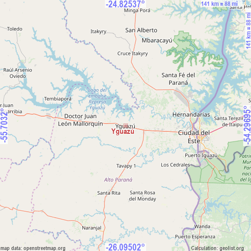
Yguazú GPS coordinates[2]
25° 27' 42.732" South, 55° 0' 0.252" West
| Map corner | latitude | longitude |
|---|---|---|
| Upper-left | -24.82537°, | -55.7032° |
| Center: | -25.46187°, | -55.00007° |
| Lower-right: | -26.09502°, | -54.29695° |
| Map W x H: | 141.2×141.2 km | = 87.7×87.7mi |
| max Lat: | -19.91667° ⇑48.1% North |
| Yguazú: | -25.46187° |
| min Lat: | ⇓51.9% South -27.38662° |
| min Long | Yguazú | max Long |
| -60.78333° | -55.00007° | -54.30694° |
| W 91.4%⇐ | ⇒8.6% E |
Elevation
Elevation of Yguazú is 261 m = 856 ft, and this is 91.3 m = 300 ft above average elevation for this country.
| Max E: |
658 m = 2159 ft | 16% |
| Yguazú | 261 m 856 ft | |
| Avg. | 169.7 m = 557 ft | |
Min E: |
46 m = 151 ft | 84% |
See also: Paraguay elevation on elevation.city.
Geographical zone
Yguazú is located in South temperate zone (between Tropic of Capricorn and the Antarctic Circle). Distance of this Southern Tropic circle is 225.2 km =139.9 mi to North.| Distance of | km | miles | from Yguazú |
|---|---|---|---|
| Equator | 2831.1 | 1759.2 | to North |
| Tropic Capricorn | 225.2 | 139.9 | to North |
| Antarctic Circle | 4570.1 | 2839.7 | to South |
| South Pole | 7176 | 4459 | to South |


Nearby cities:
15 places around Yguazú: (largest is in red/bold)
• Caaguazú
102 km =63.4 mi,  269°
269°
• Cedrales
35.3 km =21.9 mi,  127°
127°
• Ciudad del Este
39.4 km =24.5 mi,  97°
97°
• Colonia General Alfredo Stroessner
71.8 km =44.6 mi,  278°
278°
• Colonia Minga Porá
66.9 km =41.6 mi,  8°
8°
• Doctor Juan León Mallorquín
25.7 km =16 mi, 277°
• Doctor Juan Manuel Frutos
84 km =52.2 mi, 275°
• Itakyry
55 km =34.2 mi,  344°
344°
• Naranjal
59.1 km =36.7 mi,  198°
198°
• Presidente Franco
40.7 km =25.3 mi,  106°
106°
• Repatriación
95.7 km =59.5 mi, 265°
• San Alberto
56 km =34.8 mi, 10°
• Santa Rita
36.4 km =22.6 mi,  190°
190°
• Yhú
103.1 km =64.1 mi,  295°
295°
• Ñacunday
66 km =41 mi,  159°
159°
Sources, notices
• [Note1] Compared only with cities in Paraguay existing in our database
• [Src1] Map data: © OpenStreetMap contributors (CC-BY-SA)
• [Src2] Other city data from geonames.org with taken over terms of usage.
• [Src3] Geographical zone / Annual Mean Temperature by Robert A. Rohde @ Wikipedia
