Vârvor geodata
Vârvor (Dolj) is a populated place; located in Romania in Europe/Bucharest (GMT+3) time zone. With population of 630 people, there are 6005 cities with bigger population in this country. Compared to other cities in Romania, 92.8% of cities are located further ↑North; 75.2% of cities are located further →East and 62.5% of cities have higher elevation than Vârvor. Note1


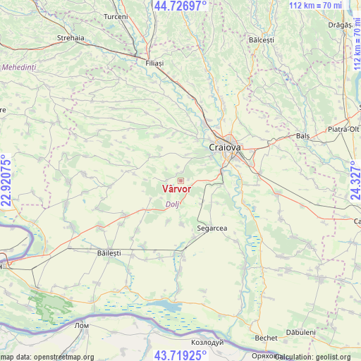
Vârvor GPS coordinates[2]
44° 13' 30.972" North, 23° 37' 25.932" East
| Map corner | latitude | longitude |
|---|---|---|
| Upper-left | 44.72697°, | 22.92075° |
| Center: | 44.22527°, | 23.62387° |
| Lower-right: | 43.71925°, | 24.327° |
| Map W x H: | 112×112 km | = 69.6×69.6mi |
| max Lat: | 48.23793° ⇑92.8% North |
| Vârvor: | 44.22527° |
| min Lat: | ⇓7.2% South 43.65638° |
| min Long | Vârvor | max Long |
| 20.31667° | 23.62387° | 29.65403° |
| W 24.8%⇐ | ⇒75.2% E |
Elevation
Elevation of Vârvor is 157 m = 515 ft, and this is 97.9 m = 321 ft below average elevation for this country.
| Max E: |
1278 m = 4193 ft | 62.5% |
| Avg. | 254.9 m = 836 ft | |
| Vârvor | 157 m = 515 ft | |
Min E: |
-2 m = -7 ft | 37.5% |
See also: Romania elevation on elevation.city.
Geographical zone
Vârvor is located in North temperate zone (between Tropic of Cancer and the Arctic Circle). Distance of this Northern Tropic circle is 2311.5 km =1436.3 mi to South.| Distance of | km | miles | from Vârvor |
|---|---|---|---|
| North Pole | 5089.7 | 3162.6 | to North |
| Arctic Circle | 2483.8 | 1543.4 | to North |
| Tropic Cancer | 2311.5 | 1436.3 | to South |
| Equator | 4917.4 | 3055.5 | to South |


Nearby cities:
15 places around Vârvor: (largest is in red/bold)
• Breasta
12.9 km =8 mi,  21°
21°
• Bucovăţ
13 km =8.1 mi,  50°
50°
• Calopăr
12.8 km =8 mi,  121°
121°
• Mârza
12.1 km =7.5 mi,  254°
254°
• Palilula
9.2 km =5.7 mi,  57°
57°
• Panaghia
8.6 km =5.3 mi,  131°
131°
• Podari
13 km =8.1 mi,  77°
77°
• Radovan
6.5 km =4 mi,  185°
185°
• Satu Nou Calopăr
13.1 km =8.1 mi, 119°
• Sălcuța
9.6 km =6 mi,  139°
139°
• Sărbătoarea
8.5 km =5.3 mi, 15°
• Tencănău
11 km =6.8 mi,  271°
271°
• Terpeziţa
12 km =7.5 mi,  308°
308°
• Vârvoru de Jos
2.5 km =1.6 mi,  328°
328°
• Întorsura
13.1 km =8.1 mi,  196°
196°
Sources, notices
• [Note1] Compared only with cities in Romania existing in our database
• [Src1] Map data: © OpenStreetMap contributors (CC-BY-SA)
• [Src2] Other city data from geonames.org with taken over terms of usage.
• [Src3] Geographical zone / Annual Mean Temperature by Robert A. Rohde @ Wikipedia
