Sălcuţa geodata
Sălcuţa (Dolj) is a seat of a second-order administrative division; located in Romania in Europe/Bucharest (GMT+3) time zone. With population of 2,509 people, there are 2154 cities with bigger population in this country. Compared to other cities in Romania, 92.1% of cities are located further ↑North; 78.1% of cities are located further →East and 57.9% of cities have higher elevation than Sălcuţa. Note1


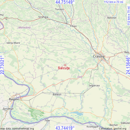
Sălcuţa GPS coordinates[2]
44° 15' 0" North, 23° 25' 59.988" East
| Map corner | latitude | longitude |
|---|---|---|
| Upper-left | 44.75149°, | 22.73021° |
| Center: | 44.25°, | 23.43333° |
| Lower-right: | 43.74419°, | 24.13646° |
| Map W x H: | 112×112 km | = 69.6×69.6mi |
| max Lat: | 48.23793° ⇑92.1% North |
| Sălcuţa: | 44.25° |
| min Lat: | ⇓7.9% South 43.65638° |
| min Long | Sălcuţa | max Long |
| 20.31667° | 23.43333° | 29.65403° |
| W 21.9%⇐ | ⇒78.1% E |
Elevation
Elevation of Sălcuţa is 174 m = 571 ft, and this is 80.9 m = 265 ft below average elevation for this country.
| Max E: |
1278 m = 4193 ft | 57.9% |
| Avg. | 254.9 m = 836 ft | |
| Sălcuţa | 174 m = 571 ft | |
Min E: |
-2 m = -7 ft | 42.1% |
See also: Romania elevation on elevation.city.
Geographical zone
Sălcuţa is located in North temperate zone (between Tropic of Cancer and the Arctic Circle). Distance of this Northern Tropic circle is 2314.2 km =1438 mi to South.| Distance of | km | miles | from Sălcuţa |
|---|---|---|---|
| North Pole | 5086.9 | 3160.9 | to North |
| Arctic Circle | 2481 | 1541.6 | to North |
| Tropic Cancer | 2314.2 | 1438 | to South |
| Equator | 4920.1 | 3057.2 | to South |


Nearby cities:
15 places around Sălcuţa: (largest is in red/bold)
• Brabova
13 km =8.1 mi,  0°
0°
• Bucovicior
8.4 km =5.2 mi,  310°
310°
• Cornu
12.7 km =7.9 mi,  261°
261°
• Căciulatu
7.2 km =4.5 mi,  352°
352°
• Giubega
13.8 km =8.6 mi,  188°
188°
• Gubaucea
7.9 km =4.9 mi,  295°
295°
• Mârza
7 km =4.3 mi,  149°
149°
• Perișor
12.3 km =7.6 mi,  164°
164°
• Pleșoi
13.7 km =8.5 mi,  35°
35°
• Plopșor
1.5 km =0.9 mi,  269°
269°
• Răchita de Jos
10.9 km =6.8 mi, 348°
• Tencănău
4.9 km =3 mi,  120°
120°
• Terpeziţa
7.4 km =4.6 mi,  50°
50°
• Vela
3.9 km =2.4 mi,  340°
340°
• Vârtop
8.3 km =5.2 mi,  234°
234°
Sources, notices
• [Note1] Compared only with cities in Romania existing in our database
• [Src1] Map data: © OpenStreetMap contributors (CC-BY-SA)
• [Src2] Other city data from geonames.org with taken over terms of usage.
• [Src3] Geographical zone / Annual Mean Temperature by Robert A. Rohde @ Wikipedia
