Preajba geodata
Preajba (Dolj) is a populated place; located in Romania in Europe/Bucharest (GMT+3) time zone. With population of 1,030 people, there are 4187 cities with bigger population in this country. Compared to other cities in Romania, 91.7% of cities are located further ↑North; 71.8% of cities are located further →East and 73.3% of cities have higher elevation than Preajba. Note1


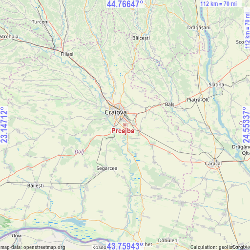
Preajba GPS coordinates[2]
44° 15' 54.396" North, 23° 51' 0.864" East
| Map corner | latitude | longitude |
|---|---|---|
| Upper-left | 44.76647°, | 23.14712° |
| Center: | 44.26511°, | 23.85024° |
| Lower-right: | 43.75943°, | 24.55337° |
| Map W x H: | 112×112 km | = 69.6×69.6mi |
| max Lat: | 48.23793° ⇑91.7% North |
| Preajba: | 44.26511° |
| min Lat: | ⇓8.3% South 43.65638° |
| min Long | Preajba | max Long |
| 20.31667° | 23.85024° | 29.65403° |
| W 28.2%⇐ | ⇒71.8% E |
Elevation
Elevation of Preajba is 116 m = 381 ft, and this is 138.9 m = 456 ft below average elevation for this country.
| Max E: |
1278 m = 4193 ft | 73.3% |
| Avg. | 254.9 m = 836 ft | |
| Preajba | 116 m = 381 ft | |
Min E: |
-2 m = -7 ft | 26.7% |
See also: Romania elevation on elevation.city.
Geographical zone
Preajba is located in North temperate zone (between Tropic of Cancer and the Arctic Circle). Distance of this Northern Tropic circle is 2315.9 km =1439 mi to South.| Distance of | km | miles | from Preajba |
|---|---|---|---|
| North Pole | 5085.2 | 3159.8 | to North |
| Arctic Circle | 2479.4 | 1540.6 | to North |
| Tropic Cancer | 2315.9 | 1439 | to South |
| Equator | 4921.8 | 3058.3 | to South |


Nearby cities:
15 places around Preajba: (largest is in red/bold)
• Braniște
4.8 km =3 mi,  277°
277°
• Bucovăţ
8.9 km =5.5 mi,  295°
295°
• Coşoveni
6.8 km =4.2 mi,  104°
104°
• Craiova
7 km =4.3 mi,  325°
325°
• Cârcea
4 km =2.5 mi,  83°
83°
• Făcăi
2.6 km =1.6 mi,  291°
291°
• Ghindeni
8.3 km =5.2 mi,  135°
135°
• Livezi
6.1 km =3.8 mi,  232°
232°
• Malu Mare
2.6 km =1.6 mi,  174°
174°
• Mofleni
8.4 km =5.2 mi, 299°
• Palilula
10.3 km =6.4 mi,  272°
272°
• Podari
5.6 km =3.5 mi,  252°
252°
• Popoveni
6 km =3.7 mi, 295°
• Secui
8.2 km =5.1 mi, 172°
• Ţuglui
9.5 km =5.9 mi,  196°
196°
Sources, notices
• [Note1] Compared only with cities in Romania existing in our database
• [Src1] Map data: © OpenStreetMap contributors (CC-BY-SA)
• [Src2] Other city data from geonames.org with taken over terms of usage.
• [Src3] Geographical zone / Annual Mean Temperature by Robert A. Rohde @ Wikipedia
