Cârcea geodata
Cârcea (Dolj) is a seat of a second-order administrative division; located in Romania in Europe/Bucharest (GMT+3) time zone. In our database, there are 7076 cities with bigger population. Compared to other cities in Romania, 91.5% of cities are located further ↑North; 71.1% of cities are located further →East and 56.3% of cities have higher elevation than Cârcea. Note1


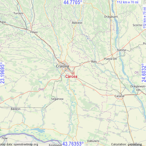
Cârcea GPS coordinates[2]
44° 16' 9.012" North, 23° 54' 0.252" East
| Map corner | latitude | longitude |
|---|---|---|
| Upper-left | 44.7705°, | 23.19695° |
| Center: | 44.26917°, | 23.90007° |
| Lower-right: | 43.76353°, | 24.6032° |
| Map W x H: | 112×112 km | = 69.6×69.6mi |
| max Lat: | 48.23793° ⇑91.5% North |
| Cârcea: | 44.26917° |
| min Lat: | ⇓8.5% South 43.65638° |
| min Long | Cârcea | max Long |
| 20.31667° | 23.90007° | 29.65403° |
| W 28.9%⇐ | ⇒71.1% E |
Elevation
Elevation of Cârcea is 181 m = 594 ft, and this is 73.9 m = 242 ft below average elevation for this country.
| Max E: |
1278 m = 4193 ft | 56.3% |
| Avg. | 254.9 m = 836 ft | |
| Cârcea | 181 m = 594 ft | |
Min E: |
-2 m = -7 ft | 43.7% |
See also: Romania elevation on elevation.city.
Geographical zone
Cârcea is located in North temperate zone (between Tropic of Cancer and the Arctic Circle). Distance of this Northern Tropic circle is 2316.4 km =1439.3 mi to South.| Distance of | km | miles | from Cârcea |
|---|---|---|---|
| North Pole | 5084.8 | 3159.5 | to North |
| Arctic Circle | 2478.9 | 1540.3 | to North |
| Tropic Cancer | 2316.4 | 1439.3 | to South |
| Equator | 4922.3 | 3058.6 | to South |


Nearby cities:
15 places around Cârcea: (largest is in red/bold)
• Braniște
8.7 km =5.4 mi,  271°
271°
• Coşoveni
3.4 km =2.1 mi,  128°
128°
• Craiova
9.6 km =6 mi,  303°
303°
• Făcăi
6.4 km =4 mi, 274°
• Ghercești
9.6 km =6 mi,  358°
358°
• Ghindeni
6.6 km =4.1 mi,  163°
163°
• Golfin
9.9 km =6.2 mi,  75°
75°
• Livezi
9.8 km =6.1 mi,  244°
244°
• Malu Mare
4.8 km =3 mi,  230°
230°
• Pieleştí
8.2 km =5.1 mi,  29°
29°
• Podari
9.5 km =5.9 mi,  257°
257°
• Popoveni
9.6 km =6 mi,  282°
282°
• Preajba
4 km =2.5 mi, 263°
• Robăneștii de Sus
10.3 km =6.4 mi,  55°
55°
• Secui
9.1 km =5.7 mi,  198°
198°
Sources, notices
• [Note1] Compared only with cities in Romania existing in our database
• [Src1] Map data: © OpenStreetMap contributors (CC-BY-SA)
• [Src2] Other city data from geonames.org with taken over terms of usage.
• [Src3] Geographical zone / Annual Mean Temperature by Robert A. Rohde @ Wikipedia
