Ozun geodata
Ozun (Covasna) is a seat of a second-order administrative division; located in Romania in Europe/Bucharest (GMT+3) time zone. With population of 4,493 people, there are 957 cities with bigger population in this country. Compared to other cities in Romania, 50.3% of cities are located further ↓South; 60.1% of cities are located further ←West and 90.1% of cities have lower elevation than Ozun. Note1


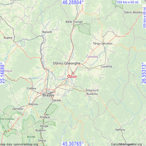
Ozun GPS coordinates[2]
45° 48' 0" North, 25° 51' 0" East
| Map corner | latitude | longitude |
|---|---|---|
| Upper-left | 46.28804°, | 25.14688° |
| Center: | 45.8°, | 25.85° |
| Lower-right: | 45.30765°, | 26.55313° |
| Map W x H: | 109×109 km | = 67.7×67.7mi |
| max Lat: | 48.23793° ⇑49.7% North |
| Ozun: | 45.8° |
| min Lat: | ⇓50.3% South 43.65638° |
| min Long | Ozun | max Long |
| 20.31667° | 25.85° | 29.65403° |
| W 60.1%⇐ | ⇒39.9% E |
Elevation
Elevation of Ozun is 513 m = 1683 ft, and this is 258.1 m = 847 ft above average elevation for this country.
| Max E: |
1278 m = 4193 ft | 9.9% |
| Ozun | 513 m 1683 ft | |
| Avg. | 254.9 m = 836 ft | |
Min E: |
-2 m = -7 ft | 90.1% |
See also: Romania elevation on elevation.city.
Geographical zone
Ozun is located in North temperate zone (between Tropic of Cancer and the Arctic Circle). Distance of this North polar circle is 2308.7 km =1434.6 mi to North.| Distance of | km | miles | from Ozun |
|---|---|---|---|
| North Pole | 4914.6 | 3053.8 | to North |
| Arctic Circle | 2308.7 | 1434.6 | to North |
| Tropic Cancer | 2486.6 | 1545.1 | to South |
| Equator | 5092.5 | 3164.3 | to South |


Nearby cities:
15 places around Ozun: (largest is in red/bold)
• Angheluș
9.2 km =5.7 mi,  18°
18°
• Chichiş
4.3 km =2.7 mi,  244°
244°
• Chilieni
5.5 km =3.4 mi,  319°
319°
• Dobolii de Jos
7.4 km =4.6 mi,  254°
254°
• Dobârlău
7.9 km =4.9 mi,  160°
160°
• Ghidfalău
11.1 km =6.9 mi,  0°
0°
• Ilieni
6.5 km =4 mi,  270°
270°
• Moacşa
11.7 km =7.3 mi,  50°
50°
• Podu Oltului
10.8 km =6.7 mi, 245°
• Prejmer
11.3 km =7 mi,  214°
214°
• Reci
8.5 km =5.3 mi, 49°
• Sfântu Gheorghe
9 km =5.6 mi,  325°
325°
• Sântionlunca
3.4 km =2.1 mi,  35°
35°
• Teliu
11.3 km =7 mi,  177°
177°
• Tunelu-Teliu
11.1 km =6.9 mi, 180°
Sources, notices
• [Note1] Compared only with cities in Romania existing in our database
• [Src1] Map data: © OpenStreetMap contributors (CC-BY-SA)
• [Src2] Other city data from geonames.org with taken over terms of usage.
• [Src3] Geographical zone / Annual Mean Temperature by Robert A. Rohde @ Wikipedia
