Iosifalău geodata
Iosifalău (Timiş) is a populated place; located in Romania in Europe/Bucharest (GMT+3) time zone. With population of 548 people, there are 6601 cities with bigger population in this country. Compared to other cities in Romania, 50.2% of cities are located further ↑North; 96.7% of cities are located further →East and 72.3% of cities have higher elevation than Iosifalău. Note1


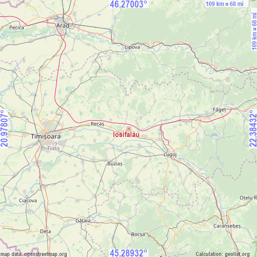
Iosifalău GPS coordinates[2]
45° 46' 54.588" North, 21° 40' 52.284" East
| Map corner | latitude | longitude |
|---|---|---|
| Upper-left | 46.27003°, | 20.97807° |
| Center: | 45.78183°, | 21.68119° |
| Lower-right: | 45.28932°, | 22.38432° |
| Map W x H: | 109×109 km | = 67.7×67.7mi |
| max Lat: | 48.23793° ⇑50.2% North |
| Iosifalău: | 45.78183° |
| min Lat: | ⇓49.8% South 43.65638° |
| min Long | Iosifalău | max Long |
| 20.31667° | 21.68119° | 29.65403° |
| W 3.3%⇐ | ⇒96.7% E |
Elevation
Elevation of Iosifalău is 119 m = 390 ft, and this is 135.9 m = 446 ft below average elevation for this country.
| Max E: |
1278 m = 4193 ft | 72.3% |
| Avg. | 254.9 m = 836 ft | |
| Iosifalău | 119 m = 390 ft | |
Min E: |
-2 m = -7 ft | 27.7% |
See also: Romania elevation on elevation.city.
Geographical zone
Iosifalău is located in North temperate zone (between Tropic of Cancer and the Arctic Circle). Distance of this North polar circle is 2310.7 km =1435.8 mi to North.| Distance of | km | miles | from Iosifalău |
|---|---|---|---|
| North Pole | 4916.6 | 3055 | to North |
| Arctic Circle | 2310.7 | 1435.8 | to North |
| Tropic Cancer | 2484.5 | 1543.8 | to South |
| Equator | 5090.5 | 3163.1 | to South |


Nearby cities:
15 places around Iosifalău: (largest is in red/bold)
• Balinţ
13.8 km =8.6 mi,  75°
75°
• Bazoș
15.2 km =9.4 mi,  250°
250°
• Belinţ
6.8 km =4.2 mi,  115°
115°
• Boldur
12.2 km =7.6 mi,  142°
142°
• Brestovăț
10.2 km =6.3 mi,  0°
0°
• Chizătău
5 km =3.1 mi,  127°
127°
• Coşteiu
13.8 km =8.6 mi,  109°
109°
• Ghizela
6.4 km =4 mi,  42°
42°
• Hitiaș
10.2 km =6.3 mi,  218°
218°
• Ohaba-Forgaci
8.4 km =5.2 mi,  146°
146°
• Racoviţa
9.9 km =6.2 mi,  200°
200°
• Recaş
14.1 km =8.8 mi,  277°
277°
• Sinersig
12.5 km =7.8 mi,  164°
164°
• Topolovăţu Mare
4.9 km =3 mi,  259°
259°
• Șanovița
4.2 km =2.6 mi,  64°
64°
Sources, notices
• [Note1] Compared only with cities in Romania existing in our database
• [Src1] Map data: © OpenStreetMap contributors (CC-BY-SA)
• [Src2] Other city data from geonames.org with taken over terms of usage.
• [Src3] Geographical zone / Annual Mean Temperature by Robert A. Rohde @ Wikipedia
