Ion Roată geodata
Ion Roată (Ialomiţa) is a seat of a second-order administrative division; located in Romania in Europe/Bucharest (GMT+3) time zone. With population of 3,689 people, there are 1332 cities with bigger population in this country. Compared to other cities in Romania, 81.1% of cities are located further ↑North; 77.9% of cities are located further ←West and 92.2% of cities have higher elevation than Ion Roată. Note1


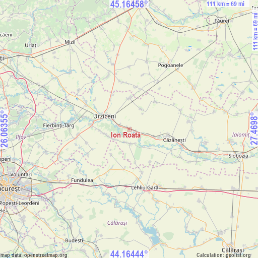
Ion Roată GPS coordinates[2]
44° 40' 0.012" North, 26° 46' 0.012" East
| Map corner | latitude | longitude |
|---|---|---|
| Upper-left | 45.16458°, | 26.06355° |
| Center: | 44.66667°, | 26.76667° |
| Lower-right: | 44.16444°, | 27.4698° |
| Map W x H: | 111.2×111.2 km | = 69.1×69.1mi |
| max Lat: | 48.23793° ⇑81.1% North |
| Ion Roată: | 44.66667° |
| min Lat: | ⇓18.9% South 43.65638° |
| min Long | Ion Roată | max Long |
| 20.31667° | 26.76667° | 29.65403° |
| W 77.9%⇐ | ⇒22.1% E |
Elevation
Elevation of Ion Roată is 48 m = 157 ft, and this is 206.9 m = 679 ft below average elevation for this country.
| Max E: |
1278 m = 4193 ft | 92.2% |
| Avg. | 254.9 m = 836 ft | |
| Ion Roată | 48 m = 157 ft | |
Min E: |
-2 m = -7 ft | 7.8% |
See also: Romania elevation on elevation.city.
Geographical zone
Ion Roată is located in North temperate zone (between Tropic of Cancer and the Arctic Circle). Distance of this Northern Tropic circle is 2360.5 km =1466.7 mi to South.| Distance of | km | miles | from Ion Roată |
|---|---|---|---|
| North Pole | 5040.6 | 3132.1 | to North |
| Arctic Circle | 2434.7 | 1512.9 | to North |
| Tropic Cancer | 2360.5 | 1466.7 | to South |
| Equator | 4966.5 | 3086 | to South |


Nearby cities:
15 places around Ion Roată: (largest is in red/bold)
• Alexeni
5.6 km =3.5 mi,  289°
289°
• Axintele
7.5 km =4.7 mi,  169°
169°
• Balaciu
9.9 km =6.2 mi,  111°
111°
• Borănești
12.8 km =8 mi,  267°
267°
• Broșteni
1.6 km =1 mi, 291°
• Butoiu
6.1 km =3.8 mi, 109°
• Bărcăneşti
9.9 km =6.2 mi,  248°
248°
• Condeești
7.4 km =4.6 mi,  233°
233°
• Grindași
8.9 km =5.5 mi,  40°
40°
• Gârbovi
13 km =8.1 mi,  0°
0°
• Manasia
8.7 km =5.4 mi,  295°
295°
• Sfântu Gheorghe
5.6 km =3.5 mi, 109°
• Sărățeni
13.2 km =8.2 mi, 105°
• Urziceni
11.9 km =7.4 mi, 297°
• Valea Măcrișului
9.9 km =6.2 mi,  30°
30°
Sources, notices
• [Note1] Compared only with cities in Romania existing in our database
• [Src1] Map data: © OpenStreetMap contributors (CC-BY-SA)
• [Src2] Other city data from geonames.org with taken over terms of usage.
• [Src3] Geographical zone / Annual Mean Temperature by Robert A. Rohde @ Wikipedia
