Axintele geodata
Axintele (Ialomiţa) is a seat of a second-order administrative division; located in Romania in Europe/Bucharest (GMT+3) time zone. With population of 2,912 people, there are 1842 cities with bigger population in this country. Compared to other cities in Romania, 82.9% of cities are located further ↑North; 78.3% of cities are located further ←West and 87.4% of cities have higher elevation than Axintele. Note1


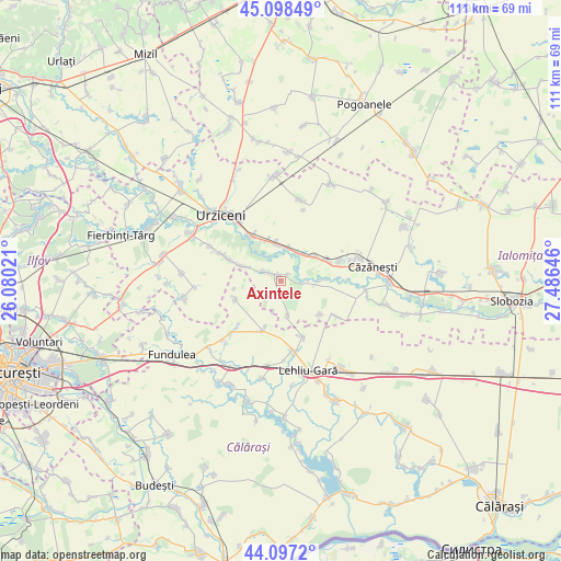
Axintele GPS coordinates[2]
44° 36' 0" North, 26° 46' 59.988" East
| Map corner | latitude | longitude |
|---|---|---|
| Upper-left | 45.09849°, | 26.08021° |
| Center: | 44.6°, | 26.78333° |
| Lower-right: | 44.0972°, | 27.48646° |
| Map W x H: | 111.3×111.3 km | = 69.2×69.2mi |
| max Lat: | 48.23793° ⇑82.9% North |
| Axintele: | 44.6° |
| min Lat: | ⇓17.1% South 43.65638° |
| min Long | Axintele | max Long |
| 20.31667° | 26.78333° | 29.65403° |
| W 78.3%⇐ | ⇒21.7% E |
Elevation
Elevation of Axintele is 70 m = 230 ft, and this is 184.9 m = 607 ft below average elevation for this country.
| Max E: |
1278 m = 4193 ft | 87.4% |
| Avg. | 254.9 m = 836 ft | |
| Axintele | 70 m = 230 ft | |
Min E: |
-2 m = -7 ft | 12.6% |
See also: Romania elevation on elevation.city.
Geographical zone
Axintele is located in North temperate zone (between Tropic of Cancer and the Arctic Circle). Distance of this Northern Tropic circle is 2353.1 km =1462.1 mi to South.| Distance of | km | miles | from Axintele |
|---|---|---|---|
| North Pole | 5048 | 3136.7 | to North |
| Arctic Circle | 2442.1 | 1517.5 | to North |
| Tropic Cancer | 2353.1 | 1462.1 | to South |
| Equator | 4959.1 | 3081.4 | to South |


Nearby cities:
15 places around Axintele: (largest is in red/bold)
• Alexeni
11.4 km =7.1 mi,  324°
324°
• Arțari
9.6 km =6 mi,  247°
247°
• Balaciu
8.7 km =5.4 mi,  64°
64°
• Broșteni
8.5 km =5.3 mi,  340°
340°
• Butoiu
7 km =4.3 mi,  39°
39°
• Bărcăneşti
11.2 km =7 mi,  289°
289°
• Condeești
7.9 km =4.9 mi, 292°
• Horia
7.1 km =4.4 mi,  167°
167°
• Ileana
13.1 km =8.1 mi,  224°
224°
• Ion Roată
7.5 km =4.7 mi,  349°
349°
• Sfântu Gheorghe
6.8 km =4.2 mi, 35°
• Sălcioara
10.8 km =6.7 mi,  133°
133°
• Săpunari
11.7 km =7.3 mi,  158°
158°
• Sărățeni
12 km =7.5 mi,  71°
71°
• Ștefănești
10.5 km =6.5 mi,  200°
200°
Sources, notices
• [Note1] Compared only with cities in Romania existing in our database
• [Src1] Map data: © OpenStreetMap contributors (CC-BY-SA)
• [Src2] Other city data from geonames.org with taken over terms of usage.
• [Src3] Geographical zone / Annual Mean Temperature by Robert A. Rohde @ Wikipedia
