Homorog geodata
Homorog (Bihor) is a populated place; located in Romania in Europe/Bucharest (GMT+3) time zone. With population of 768 people, there are 5193 cities with bigger population in this country. Compared to other cities in Romania, 74.8% of cities are located further ↓South; 96.1% of cities are located further →East and 78.4% of cities have higher elevation than Homorog. Note1


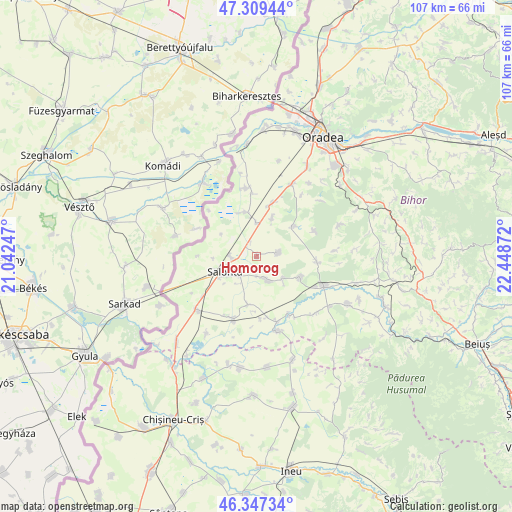
Homorog GPS coordinates[2]
46° 49' 49.944" North, 21° 44' 44.124" East
| Map corner | latitude | longitude |
|---|---|---|
| Upper-left | 47.30944°, | 21.04247° |
| Center: | 46.83054°, | 21.74559° |
| Lower-right: | 46.34734°, | 22.44872° |
| Map W x H: | 107×107 km | = 66.5×66.5mi |
| max Lat: | 48.23793° ⇑25.2% North |
| Homorog: | 46.83054° |
| min Lat: | ⇓74.8% South 43.65638° |
| min Long | Homorog | max Long |
| 20.31667° | 21.74559° | 29.65403° |
| W 3.9%⇐ | ⇒96.1% E |
Elevation
Elevation of Homorog is 100 m = 328 ft, and this is 154.9 m = 508 ft below average elevation for this country.
| Max E: |
1278 m = 4193 ft | 78.4% |
| Avg. | 254.9 m = 836 ft | |
| Homorog | 100 m = 328 ft | |
Min E: |
-2 m = -7 ft | 21.6% |
See also: Romania elevation on elevation.city.
Geographical zone
Homorog is located in North temperate zone (between Tropic of Cancer and the Arctic Circle). Distance of this North polar circle is 2194.1 km =1363.4 mi to North.| Distance of | km | miles | from Homorog |
|---|---|---|---|
| North Pole | 4800 | 2982.6 | to North |
| Arctic Circle | 2194.1 | 1363.4 | to North |
| Tropic Cancer | 2601.1 | 1616.2 | to South |
| Equator | 5207.1 | 3235.5 | to South |


Nearby cities:
15 places around Homorog: (largest is in red/bold)
• Arpășel
10.4 km =6.5 mi,  190°
190°
• Bicaci
8.6 km =5.3 mi,  22°
22°
• Cefa
9.6 km =6 mi,  354°
354°
• Căuașd
7.2 km =4.5 mi,  127°
127°
• Gepiu
11.6 km =7.2 mi, 16°
• Ghiorac
13.9 km =8.6 mi,  200°
200°
• Gurbediu
9.9 km =6.2 mi,  114°
114°
• Husasău de Tinca
13.1 km =8.1 mi,  96°
96°
• Ianoșda
4.8 km =3 mi,  80°
80°
• Inand
7.1 km =4.4 mi,  3°
3°
• Mădăraş
4.7 km =2.9 mi,  273°
273°
• Salonta
8 km =5 mi,  244°
244°
• Sititelec
13 km =8.1 mi,  66°
66°
• Tulca
6 km =3.7 mi,  151°
151°
• Tăut
14.2 km =8.8 mi, 150°
Sources, notices
• [Note1] Compared only with cities in Romania existing in our database
• [Src1] Map data: © OpenStreetMap contributors (CC-BY-SA)
• [Src2] Other city data from geonames.org with taken over terms of usage.
• [Src3] Geographical zone / Annual Mean Temperature by Robert A. Rohde @ Wikipedia
