Dălghiu geodata
Dălghiu (Braşov) is a populated place; located in Romania in Europe/Bucharest (GMT+3) time zone. With population of 878 people, there are 4714 cities with bigger population in this country. Compared to other cities in Romania, 54% of cities are located further ↑North; 61.2% of cities are located further ←West and 99.3% of cities have lower elevation than Dălghiu. Note1


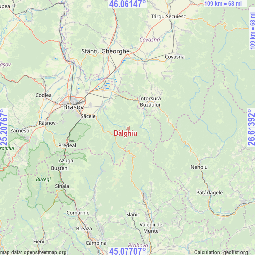
Dălghiu GPS coordinates[2]
45° 34' 17.148" North, 25° 54' 38.844" East
| Map corner | latitude | longitude |
|---|---|---|
| Upper-left | 46.06147°, | 25.20767° |
| Center: | 45.57143°, | 25.91079° |
| Lower-right: | 45.07707°, | 26.61392° |
| Map W x H: | 109.5×109.5 km | = 68×68mi |
| max Lat: | 48.23793° ⇑54% North |
| Dălghiu: | 45.57143° |
| min Lat: | ⇓46% South 43.65638° |
| min Long | Dălghiu | max Long |
| 20.31667° | 25.91079° | 29.65403° |
| W 61.2%⇐ | ⇒38.8% E |
Elevation
Elevation of Dălghiu is 905 m = 2969 ft, and this is 650.1 m = 2133 ft above average elevation for this country.
| Max E: |
1278 m = 4193 ft | 0.7% |
| Dălghiu | 905 m 2969 ft | |
| Avg. | 254.9 m = 836 ft | |
Min E: |
-2 m = -7 ft | 99.3% |
See also: Romania elevation on elevation.city.
Geographical zone
Dălghiu is located in North temperate zone (between Tropic of Cancer and the Arctic Circle). Distance of this North polar circle is 2334.1 km =1450.3 mi to North.| Distance of | km | miles | from Dălghiu |
|---|---|---|---|
| North Pole | 4940 | 3069.6 | to North |
| Arctic Circle | 2334.1 | 1450.3 | to North |
| Tropic Cancer | 2461.1 | 1529.3 | to South |
| Equator | 5067.1 | 3148.5 | to South |


Nearby cities:
15 places around Dălghiu: (largest is in red/bold)
• Acriș
9.6 km =6 mi,  41°
41°
• Brădet
11.1 km =6.9 mi, 35°
• Budila
13.7 km =8.5 mi,  320°
320°
• Buzăiel
9.6 km =6 mi,  77°
77°
• Crivina
5.8 km =3.6 mi, 76°
• Floroaia
16 km =9.9 mi,  30°
30°
• Purcăreni
12.4 km =7.7 mi,  311°
311°
• Sita Buzăului
14.9 km =9.3 mi,  54°
54°
• Săcele
16.3 km =10.1 mi,  287°
287°
• Teliu
14.8 km =9.2 mi,  343°
343°
• Tunelu-Teliu
15.1 km =9.4 mi, 341°
• Tărlungeni
14.3 km =8.9 mi,  298°
298°
• Vama Buzăului
7 km =4.3 mi,  66°
66°
• Zizin
12.6 km =7.8 mi, 305°
• Întorsura Buzăului
15.7 km =9.8 mi, 37°
Sources, notices
• [Note1] Compared only with cities in Romania existing in our database
• [Src1] Map data: © OpenStreetMap contributors (CC-BY-SA)
• [Src2] Other city data from geonames.org with taken over terms of usage.
• [Src3] Geographical zone / Annual Mean Temperature by Robert A. Rohde @ Wikipedia
