Croici geodata
Croici (Gorj) is a populated place; located in Romania in Europe/Bucharest (GMT+3) time zone. With population of 512 people, there are 6930 cities with bigger population in this country. Compared to other cities in Romania, 75.6% of cities are located further ↑North; 83.1% of cities are located further →East and 61.7% of cities have lower elevation than Croici. Note1


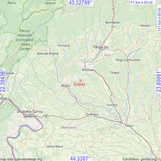
Croici GPS coordinates[2]
44° 49' 53.4" North, 23° 5' 50.928" East
| Map corner | latitude | longitude |
|---|---|---|
| Upper-left | 45.32799°, | 22.39436° |
| Center: | 44.8315°, | 23.09748° |
| Lower-right: | 44.3307°, | 23.80061° |
| Map W x H: | 110.9×110.9 km | = 68.9×68.9mi |
| max Lat: | 48.23793° ⇑75.6% North |
| Croici: | 44.8315° |
| min Lat: | ⇓24.4% South 43.65638° |
| min Long | Croici | max Long |
| 20.31667° | 23.09748° | 29.65403° |
| W 16.9%⇐ | ⇒83.1% E |
Elevation
Elevation of Croici is 273 m = 896 ft, and this is 18.1 m = 59 ft above average elevation for this country.
| Max E: |
1278 m = 4193 ft | 38.3% |
| Croici | 273 m 896 ft | |
| Avg. | 254.9 m = 836 ft | |
Min E: |
-2 m = -7 ft | 61.7% |
See also: Romania elevation on elevation.city.
Geographical zone
Croici is located in North temperate zone (between Tropic of Cancer and the Arctic Circle). Distance of this Northern Tropic circle is 2378.9 km =1478.2 mi to South.| Distance of | km | miles | from Croici |
|---|---|---|---|
| North Pole | 5022.3 | 3120.7 | to North |
| Arctic Circle | 2416.4 | 1501.5 | to North |
| Tropic Cancer | 2378.9 | 1478.2 | to South |
| Equator | 4984.8 | 3097.4 | to South |


Nearby cities:
15 places around Croici: (largest is in red/bold)
• Brădet
4.4 km =2.7 mi,  333°
333°
• Corobăi
5.4 km =3.4 mi,  130°
130°
• Drăgoteşti
6.5 km =4 mi,  122°
122°
• Fărcăşeşti
9 km =5.6 mi,  64°
64°
• Horăști
8.3 km =5.2 mi,  232°
232°
• Miculești
4.2 km =2.6 mi,  258°
258°
• Mătăsari
2.3 km =1.4 mi, 331°
• Negomir
5.5 km =3.4 mi,  87°
87°
• Pinoasa
8.5 km =5.3 mi,  0°
0°
• Ploștina
8.7 km =5.4 mi, 264°
• Roșia Jiu
8.3 km =5.2 mi,  38°
38°
• Runcurel
6.8 km =4.2 mi,  296°
296°
• Slivileşti
6.1 km =3.8 mi,  152°
152°
• Strâmtu
6.3 km =3.9 mi,  168°
168°
• Trestioara
8.7 km =5.4 mi, 131°
Sources, notices
• [Note1] Compared only with cities in Romania existing in our database
• [Src1] Map data: © OpenStreetMap contributors (CC-BY-SA)
• [Src2] Other city data from geonames.org with taken over terms of usage.
• [Src3] Geographical zone / Annual Mean Temperature by Robert A. Rohde @ Wikipedia
