Coteana geodata
Coteana (Olt) is a seat of a second-order administrative division; located in Romania in Europe/Bucharest (GMT+3) time zone. With population of 2,960 people, there are 1811 cities with bigger population in this country. Compared to other cities in Romania, 90.8% of cities are located further ↑North; 60.7% of cities are located further →East and 65.9% of cities have higher elevation than Coteana. Note1


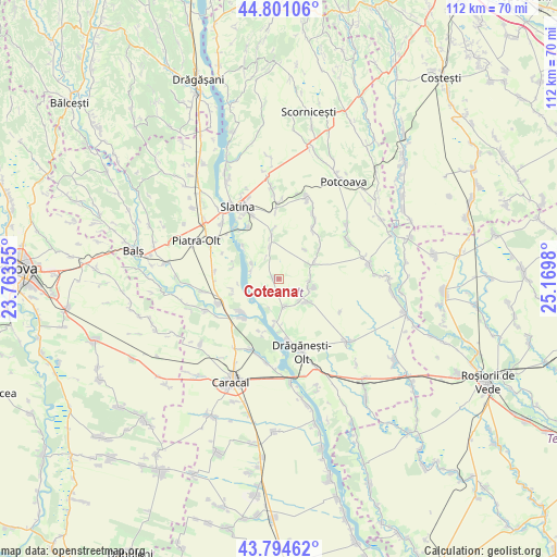
Coteana GPS coordinates[2]
44° 18' 0" North, 24° 28' 0.012" East
| Map corner | latitude | longitude |
|---|---|---|
| Upper-left | 44.80106°, | 23.76355° |
| Center: | 44.3°, | 24.46667° |
| Lower-right: | 43.79462°, | 25.1698° |
| Map W x H: | 111.9×111.9 km | = 69.5×69.5mi |
| max Lat: | 48.23793° ⇑90.8% North |
| Coteana: | 44.3° |
| min Lat: | ⇓9.2% South 43.65638° |
| min Long | Coteana | max Long |
| 20.31667° | 24.46667° | 29.65403° |
| W 39.3%⇐ | ⇒60.7% E |
Elevation
Elevation of Coteana is 143 m = 469 ft, and this is 111.9 m = 367 ft below average elevation for this country.
| Max E: |
1278 m = 4193 ft | 65.9% |
| Avg. | 254.9 m = 836 ft | |
| Coteana | 143 m = 469 ft | |
Min E: |
-2 m = -7 ft | 34.1% |
See also: Romania elevation on elevation.city.
Geographical zone
Coteana is located in North temperate zone (between Tropic of Cancer and the Arctic Circle). Distance of this Northern Tropic circle is 2319.8 km =1441.5 mi to South.| Distance of | km | miles | from Coteana |
|---|---|---|---|
| North Pole | 5081.4 | 3157.4 | to North |
| Arctic Circle | 2475.5 | 1538.2 | to North |
| Tropic Cancer | 2319.8 | 1441.5 | to South |
| Equator | 4925.7 | 3060.7 | to South |


Nearby cities:
15 places around Coteana: (largest is in red/bold)
• Alimănești
7.5 km =4.7 mi,  129°
129°
• Brebeni
7.5 km =4.7 mi,  349°
349°
• Bălănești
5.7 km =3.5 mi,  167°
167°
• Bărcănești
6.4 km =4 mi,  89°
89°
• Cioroiu
9.6 km =6 mi,  225°
225°
• Greci
8.1 km =5 mi,  65°
65°
• Greci
9.3 km =5.8 mi,  257°
257°
• Ipotești
5.9 km =3.7 mi,  298°
298°
• Izvoarele
5.4 km =3.4 mi, 132°
• Lisa
7.8 km =4.8 mi,  42°
42°
• Mărgheni
9.7 km =6 mi,  290°
290°
• Ociogi
9.5 km =5.9 mi,  283°
283°
• Schitu
9.7 km =6 mi,  55°
55°
• Vâlcele
6.4 km =4 mi,  107°
107°
• Vâlcelele de Sus
7.5 km =4.7 mi,  103°
103°
Sources, notices
• [Note1] Compared only with cities in Romania existing in our database
• [Src1] Map data: © OpenStreetMap contributors (CC-BY-SA)
• [Src2] Other city data from geonames.org with taken over terms of usage.
• [Src3] Geographical zone / Annual Mean Temperature by Robert A. Rohde @ Wikipedia
