Kanjiža geodata
Kanjiža (Vojvodina) is a seat of a third-order administrative division; located in Serbia in Europe/Belgrade (GMT+2) time zone. With population of 10,200 people, there are 54 cities with bigger population in this country. Compared to other cities in Serbia, 99.8% of cities are located further ↓South; 66.4% of cities are located further →East and 71.9% of cities have higher elevation than Kanjiža. Note1


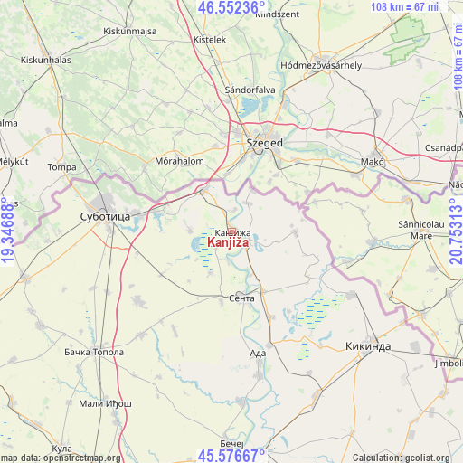
Kanjiža GPS coordinates[2]
46° 4' 0.012" North, 20° 3' 0" East
| Map corner | latitude | longitude |
|---|---|---|
| Upper-left | 46.55236°, | 19.34688° |
| Center: | 46.06667°, | 20.05° |
| Lower-right: | 45.57667°, | 20.75313° |
| Map W x H: | 108.5×108.5 km | = 67.4×67.4mi |
| max Lat: | 46.1° ⇑0.2% North |
| Kanjiža: | 46.06667° |
| min Lat: | ⇓99.8% South 42.25846° |
| min Long | Kanjiža | max Long |
| 18.9276° | 20.05° | 22.77556° |
| W 33.6%⇐ | ⇒66.4% E |
Elevation
Elevation of Kanjiža is 79 m = 259 ft, and this is 97.4 m = 320 ft below average elevation for this country.
| Max E: |
1421 m = 4662 ft | 71.9% |
| Avg. | 176.4 m = 579 ft | |
| Kanjiža | 79 m = 259 ft | |
Min E: |
49 m = 161 ft | 28.1% |
See also: Serbia elevation on elevation.city.
Geographical zone
Kanjiža is located in North temperate zone (between Tropic of Cancer and the Arctic Circle). Distance of this North polar circle is 2279 km =1416.1 mi to North.| Distance of | km | miles | from Kanjiža |
|---|---|---|---|
| North Pole | 4884.9 | 3035.3 | to North |
| Arctic Circle | 2279 | 1416.1 | to North |
| Tropic Cancer | 2516.2 | 1563.5 | to South |
| Equator | 5122.1 | 3182.7 | to South |


Nearby cities:
15 places around Kanjiža: (largest is in red/bold)
• Ada
30 km =18.6 mi,  168°
168°
• Adorjan
7.1 km =4.4 mi,  186°
186°
• Crna Bara
20.3 km =12.6 mi,  120°
120°
• Gornji Breg
16.5 km =10.3 mi, 188°
• Jazovo
22.9 km =14.2 mi,  144°
144°
• Mokrin
31.6 km =19.6 mi, 117°
• Novi Kneževac
4.3 km =2.7 mi, 115°
• Ostojićevo
21.7 km =13.5 mi,  155°
155°
• Padej
28 km =17.4 mi, 161°
• Sajan
30.6 km =19 mi, 144°
• Sanad
11 km =6.8 mi, 156°
• Senta
15.6 km =9.7 mi, 172°
• Subotica
29.8 km =18.5 mi,  277°
277°
• Vrbica
21.4 km =13.3 mi,  108°
108°
• Čoka
15.6 km =9.7 mi,  152°
152°
Sources, notices
• [Note1] Compared only with cities in Serbia existing in our database
• [Src1] Map data: © OpenStreetMap contributors (CC-BY-SA)
• [Src2] Other city data from geonames.org with taken over terms of usage.
• [Src3] Geographical zone / Annual Mean Temperature by Robert A. Rohde @ Wikipedia
