Požarevac geodata
Požarevac (Central Serbia) is a seat of a second-order administrative division; located in Serbia in Europe/Belgrade (GMT+2) time zone. With population of 41,736 people, there are 22 cities with bigger population in this country. Compared to other cities in Serbia, 63.5% of cities are located further ↑North; 79.1% of cities are located further ←West and 67.1% of cities have higher elevation than Požarevac. Note1


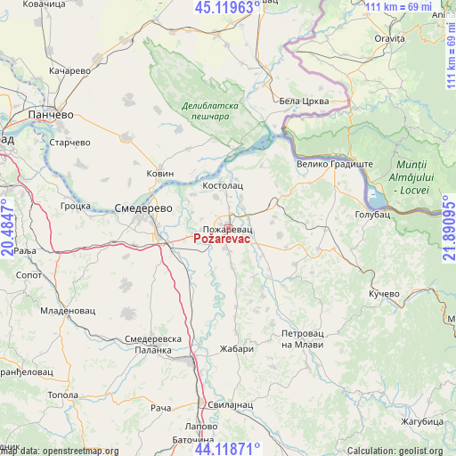
Požarevac GPS coordinates[2]
44° 37' 16.788" North, 21° 11' 16.152" East
| Map corner | latitude | longitude |
|---|---|---|
| Upper-left | 45.11963°, | 20.4847° |
| Center: | 44.62133°, | 21.18782° |
| Lower-right: | 44.11871°, | 21.89095° |
| Map W x H: | 111.3×111.3 km | = 69.2×69.2mi |
| max Lat: | 46.1° ⇑63.5% North |
| Požarevac: | 44.62133° |
| min Lat: | ⇓36.5% South 42.25846° |
| min Long | Požarevac | max Long |
| 18.9276° | 21.18782° | 22.77556° |
| W 79.1%⇐ | ⇒20.9% E |
Elevation
Elevation of Požarevac is 80 m = 262 ft, and this is 96.4 m = 316 ft below average elevation for this country.
| Max E: |
1421 m = 4662 ft | 67.1% |
| Avg. | 176.4 m = 579 ft | |
| Požarevac | 80 m = 262 ft | |
Min E: |
49 m = 161 ft | 32.9% |
See also: Požarevac elevation on elevation.city.
Geographical zone
Požarevac is located in North temperate zone (between Tropic of Cancer and the Arctic Circle). Distance of this Northern Tropic circle is 2355.5 km =1463.6 mi to South.| Distance of | km | miles | from Požarevac |
|---|---|---|---|
| North Pole | 5045.6 | 3135.2 | to North |
| Arctic Circle | 2439.7 | 1516 | to North |
| Tropic Cancer | 2355.5 | 1463.6 | to South |
| Equator | 4961.4 | 3082.9 | to South |


Nearby cities:
15 places around Požarevac: (largest is in red/bold)
• Bela Crkva
35.7 km =22.2 mi,  30°
30°
• Golubac
35.3 km =21.9 mi,  84°
84°
• Grocka
37.7 km =23.4 mi,  278°
278°
• Kovin
21.8 km =13.5 mi,  309°
309°
• Kučevo
41.4 km =25.7 mi,  112°
112°
• Lugavčina
14.3 km =8.9 mi,  220°
220°
• Malo Crniće
10.6 km =6.6 mi,  133°
133°
• Petrovac
32.8 km =20.4 mi,  145°
145°
• Smederevo
21.1 km =13.1 mi, 283°
• Smederevska Palanka
33.8 km =21 mi,  212°
212°
• Svilajnac
43.1 km =26.8 mi,  179°
179°
• Turija
37.4 km =23.2 mi, 107°
• Velika Plana
33.2 km =20.6 mi,  195°
195°
• Veliko Gradište
30.4 km =18.9 mi,  58°
58°
• Žabari
29.6 km =18.4 mi, 175°
Sources, notices
• [Note1] Compared only with cities in Serbia existing in our database
• [Src1] Map data: © OpenStreetMap contributors (CC-BY-SA)
• [Src2] Other city data from geonames.org with taken over terms of usage.
• [Src3] Geographical zone / Annual Mean Temperature by Robert A. Rohde @ Wikipedia
