Grocka geodata
Grocka (Central Serbia) is a seat of a third-order administrative division; located in Serbia in Europe/Belgrade (GMT+2) time zone. In our database, there are 365 cities with bigger population. Compared to other cities in Serbia, 60.5% of cities are located further ↑North; 68% of cities are located further ←West and 54.9% of cities have higher elevation than Grocka. Note1
Administrative division(s):
- Level 1: Central Serbia
- Level 2: Belgrade
- Level 3: Opština Beograd-Grocka


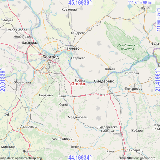
Grocka GPS coordinates[2]
44° 40' 17.472" North, 20° 42' 59.328" East
| Map corner | latitude | longitude |
|---|---|---|
| Upper-left | 45.16939°, | 20.01336° |
| Center: | 44.67152°, | 20.71648° |
| Lower-right: | 44.16934°, | 21.41961° |
| Map W x H: | 111.2×111.2 km | = 69.1×69.1mi |
| max Lat: | 46.1° ⇑60.5% North |
| Grocka: | 44.67152° |
| min Lat: | ⇓39.5% South 42.25846° |
| min Long | Grocka | max Long |
| 18.9276° | 20.71648° | 22.77556° |
| W 68%⇐ | ⇒32% E |
Elevation
Elevation of Grocka is 85 m = 279 ft, and this is 91.4 m = 300 ft below average elevation for this country.
| Max E: |
1421 m = 4662 ft | 54.9% |
| Avg. | 176.4 m = 579 ft | |
| Grocka | 85 m = 279 ft | |
Min E: |
49 m = 161 ft | 45.1% |
See also: Serbia elevation on elevation.city.
Geographical zone
Grocka is located in North temperate zone (between Tropic of Cancer and the Arctic Circle). Distance of this Northern Tropic circle is 2361.1 km =1467.1 mi to South.| Distance of | km | miles | from Grocka |
|---|---|---|---|
| North Pole | 5040.1 | 3131.8 | to North |
| Arctic Circle | 2434.2 | 1512.5 | to North |
| Tropic Cancer | 2361.1 | 1467.1 | to South |
| Equator | 4967 | 3086.3 | to South |


Nearby cities:
15 places around Grocka: (largest is in red/bold)
• Barajevo
25.9 km =16.1 mi,  246°
246°
• Belgrade
24.7 km =15.3 mi,  306°
306°
• Kovin
22.2 km =13.8 mi,  67°
67°
• Mladenovac
25.9 km =16.1 mi,  183°
183°
• Palilula
22.2 km =13.8 mi, 314°
• Pančevo
23 km =14.3 mi,  345°
345°
• Rakovica
23.1 km =14.4 mi,  289°
289°
• Rušanj
21.1 km =13.1 mi,  273°
273°
• Savski Venac
23.9 km =14.9 mi,  299°
299°
• Smederevo
16.7 km =10.4 mi,  92°
92°
• Sopot
20.3 km =12.6 mi,  213°
213°
• Sremčica
25.6 km =15.9 mi, 271°
• Voždovac
22.4 km =13.9 mi, 301°
• Vračar
23.4 km =14.5 mi, 305°
• Zvezdara
18.5 km =11.5 mi, 308°
Sources, notices
• [Note1] Compared only with cities in Serbia existing in our database
• [Src1] Map data: © OpenStreetMap contributors (CC-BY-SA)
• [Src2] Other city data from geonames.org with taken over terms of usage.
• [Src3] Geographical zone / Annual Mean Temperature by Robert A. Rohde @ Wikipedia
