Ostružnica geodata
Ostružnica (Central Serbia) is a populated place; located in Serbia in Europe/Belgrade (GMT+2) time zone. With population of 4,060 people, there are 110 cities with bigger population in this country. Compared to other cities in Serbia, 57.1% of cities are located further ↑North; 51.5% of cities are located further →East and 84.8% of cities have higher elevation than Ostružnica. Note1
Administrative division(s):
- Level 1: Central Serbia
- Level 2: Belgrade
- Level 3: Opština Beograd-Čukarica


Ostružnica GPS coordinates[2]
44° 43' 39.684" North, 20° 19' 6.42" East
| Map corner | latitude | longitude |
|---|---|---|
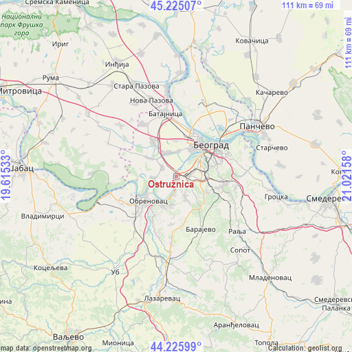
| Upper-left | 45.22507°, | 19.61533° |
| Center: | 44.72769°, | 20.31845° |
| Lower-right: | 44.22599°, | 21.02158° |
| Map W x H: | 111.1×111.1 km | = 69×69mi |
| max Lat: | 46.1° ⇑57.1% North |
| Ostružnica: | 44.72769° |
| min Lat: | ⇓42.9% South 42.25846° |
| min Long | Ostružnica | max Long |
| 18.9276° | 20.31845° | 22.77556° |
| W 48.5%⇐ | ⇒51.5% E |
Elevation
Elevation of Ostružnica is 77 m = 253 ft, and this is 99.4 m = 326 ft below average elevation for this country.
| Max E: |
1421 m = 4662 ft | 84.8% |
| Avg. | 176.4 m = 579 ft | |
| Ostružnica | 77 m = 253 ft | |
Min E: |
49 m = 161 ft | 15.2% |
See also: Serbia elevation on elevation.city.
Geographical zone
Ostružnica is located in North temperate zone (between Tropic of Cancer and the Arctic Circle). Distance of this Northern Tropic circle is 2367.3 km =1471 mi to South.| Distance of | km | miles | from Ostružnica |
|---|---|---|---|
| North Pole | 5033.8 | 3127.9 | to North |
| Arctic Circle | 2427.9 | 1508.6 | to North |
| Tropic Cancer | 2367.3 | 1471 | to South |
| Equator | 4973.3 | 3090.3 | to South |


Nearby cities:
15 places around Ostružnica: (largest is in red/bold)
• Barič
9.8 km =6.1 mi,  208°
208°
• Bečmen
10.6 km =6.6 mi,  303°
303°
• Boljevci
7.5 km =4.7 mi,  266°
266°
• Dobanovci
13.2 km =8.2 mi,  326°
326°
• Mala Moštanica
10 km =6.2 mi,  185°
185°
• Novi Beograd
12 km =7.5 mi,  43°
43°
• Obrenovac
12.4 km =7.7 mi,  229°
229°
• Rakovica
9.8 km =6.1 mi,  80°
80°
• Rušanj
11.4 km =7.1 mi,  114°
114°
• Savski Venac
12.1 km =7.5 mi,  61°
61°
• Sremčica
8.2 km =5.1 mi,  134°
134°
• Surčin
7.9 km =4.9 mi,  337°
337°
• Umka
5.6 km =3.5 mi, 191°
• Velika Moštanica
7.5 km =4.7 mi,  158°
158°
• Čukarica
10.1 km =6.3 mi,  52°
52°
Sources, notices
• [Note1] Compared only with cities in Serbia existing in our database
• [Src1] Map data: © OpenStreetMap contributors (CC-BY-SA)
• [Src2] Other city data from geonames.org with taken over terms of usage.
• [Src3] Geographical zone / Annual Mean Temperature by Robert A. Rohde @ Wikipedia
