Dobanovci geodata
Dobanovci (Central Serbia) is a populated place; located in Serbia in Europe/Belgrade (GMT+2) time zone. With population of 7,592 people, there are 65 cities with bigger population in this country. Compared to other cities in Serbia, 51% of cities are located further ↑North; 56.9% of cities are located further →East and 78.9% of cities have higher elevation than Dobanovci. Note1
Administrative division(s):
- Level 1: Central Serbia
- Level 2: Belgrade
- Level 3: Opština Beograd-Surčin


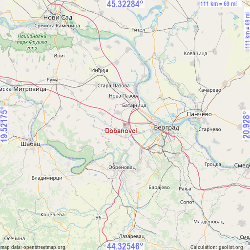
Dobanovci GPS coordinates[2]
44° 49' 34.716" North, 20° 13' 29.532" East
| Map corner | latitude | longitude |
|---|---|---|
| Upper-left | 45.32284°, | 19.52175° |
| Center: | 44.82631°, | 20.22487° |
| Lower-right: | 44.32546°, | 20.928° |
| Map W x H: | 110.9×110.9 km | = 68.9×68.9mi |
| max Lat: | 46.1° ⇑51% North |
| Dobanovci: | 44.82631° |
| min Lat: | ⇓49% South 42.25846° |
| min Long | Dobanovci | max Long |
| 18.9276° | 20.22487° | 22.77556° |
| W 43.1%⇐ | ⇒56.9% E |
Elevation
Elevation of Dobanovci is 78 m = 256 ft, and this is 98.4 m = 323 ft below average elevation for this country.
| Max E: |
1421 m = 4662 ft | 78.9% |
| Avg. | 176.4 m = 579 ft | |
| Dobanovci | 78 m = 256 ft | |
Min E: |
49 m = 161 ft | 21.1% |
See also: Serbia elevation on elevation.city.
Geographical zone
Dobanovci is located in North temperate zone (between Tropic of Cancer and the Arctic Circle). Distance of this Northern Tropic circle is 2378.3 km =1477.8 mi to South.| Distance of | km | miles | from Dobanovci |
|---|---|---|---|
| North Pole | 5022.8 | 3121 | to North |
| Arctic Circle | 2417 | 1501.9 | to North |
| Tropic Cancer | 2378.3 | 1477.8 | to South |
| Equator | 4984.2 | 3097 | to South |


Nearby cities:
15 places around Dobanovci: (largest is in red/bold)
• Bečmen
5.4 km =3.4 mi,  196°
196°
• Boljevci
11.4 km =7.1 mi,  180°
180°
• Nova Pazova
13.1 km =8.1 mi,  358°
358°
• Novi Banovci
15.2 km =9.4 mi,  16°
16°
• Novi Beograd
15.9 km =9.9 mi,  98°
98°
• Ostružnica
13.2 km =8.2 mi,  146°
146°
• Stara Pazova
18.4 km =11.4 mi,  344°
344°
• Stari Banovci
18.2 km =11.3 mi,  14°
14°
• Surčin
5.7 km =3.5 mi,  130°
130°
• Ugrinovci
6.3 km =3.9 mi,  332°
332°
• Umka
17.6 km =10.9 mi,  159°
159°
• Vojka
13.6 km =8.5 mi, 335°
• Zemun
14.1 km =8.8 mi,  81°
81°
• Čukarica
16.2 km =10.1 mi,  107°
107°
• Šimanovci
11.8 km =7.3 mi,  296°
296°
Sources, notices
• [Note1] Compared only with cities in Serbia existing in our database
• [Src1] Map data: © OpenStreetMap contributors (CC-BY-SA)
• [Src2] Other city data from geonames.org with taken over terms of usage.
• [Src3] Geographical zone / Annual Mean Temperature by Robert A. Rohde @ Wikipedia
