Novi Pazar geodata
Novi Pazar (Central Serbia) is a seat of a third-order administrative division; located in Serbia in Europe/Belgrade (GMT+2) time zone. With population of 85,996 people, there are 8 cities with bigger population in this country. Compared to other cities in Serbia, 92.7% of cities are located further ↑North; 59.2% of cities are located further ←West and 95.7% of cities have lower elevation than Novi Pazar. Note1


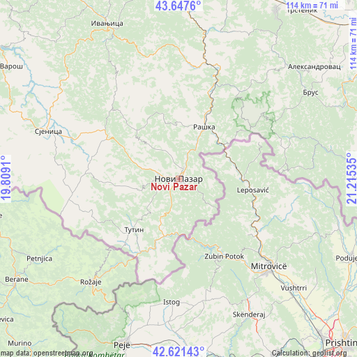
Novi Pazar GPS coordinates[2]
43° 8' 12.012" North, 20° 30' 43.992" East
| Map corner | latitude | longitude |
|---|---|---|
| Upper-left | 43.6476°, | 19.8091° |
| Center: | 43.13667°, | 20.51222° |
| Lower-right: | 42.62143°, | 21.21535° |
| Map W x H: | 114.1×114.1 km | = 70.9×70.9mi |
| max Lat: | 46.1° ⇑92.7% North |
| Novi Pazar: | 43.13667° |
| min Lat: | ⇓7.3% South 42.25846° |
| min Long | Novi Pazar | max Long |
| 18.9276° | 20.51222° | 22.77556° |
| W 59.2%⇐ | ⇒40.8% E |
Elevation
Elevation of Novi Pazar is 511 m = 1677 ft, and this is 334.6 m = 1098 ft above average elevation for this country.
| Max E: |
1421 m = 4662 ft | 4.3% |
| Novi Pazar | 511 m 1677 ft | |
| Avg. | 176.4 m = 579 ft | |
Min E: |
49 m = 161 ft | 95.7% |
See also: Novi Pazar elevation on elevation.city.
Geographical zone
Novi Pazar is located in North temperate zone (between Tropic of Cancer and the Arctic Circle). Distance of this Northern Tropic circle is 2190.4 km =1361.1 mi to South.| Distance of | km | miles | from Novi Pazar |
|---|---|---|---|
| North Pole | 5210.7 | 3237.8 | to North |
| Arctic Circle | 2604.8 | 1618.5 | to North |
| Tropic Cancer | 2190.4 | 1361.1 | to South |
| Equator | 4796.3 | 2980.3 | to South |


Nearby cities:
15 places around Novi Pazar: (largest is in red/bold)
• Aleksandrovac
56.5 km =35.1 mi,  50°
50°
• Blace
65.1 km =40.5 mi,  74°
74°
• Ivanjica
54.3 km =33.7 mi,  335°
335°
• Kraljevo
67.1 km =41.7 mi,  12°
12°
• Kuršumlija
61.8 km =38.4 mi,  89°
89°
• Nova Varoš
67.2 km =41.8 mi,  302°
302°
• Osječenik
53 km =32.9 mi,  271°
271°
• Raška
18.7 km =11.6 mi,  26°
26°
• Sjenica
44.2 km =27.5 mi,  290°
290°
• Sokolovica
18.2 km =11.3 mi, 298°
• Sokolovo Brdo
57.3 km =35.6 mi, 270°
• Suvi Do
67.9 km =42.2 mi,  78°
78°
• Trstenik
66.5 km =41.3 mi,  36°
36°
• Tutin
21.9 km =13.6 mi,  222°
222°
• Vrnjačka Banja
62.8 km =39 mi, 29°
Sources, notices
• [Note1] Compared only with cities in Serbia existing in our database
• [Src1] Map data: © OpenStreetMap contributors (CC-BY-SA)
• [Src2] Other city data from geonames.org with taken over terms of usage.
• [Src3] Geographical zone / Annual Mean Temperature by Robert A. Rohde @ Wikipedia
