Tutin geodata
Tutin (Central Serbia) is a seat of a third-order administrative division; located in Serbia in Europe/Belgrade (GMT+2) time zone. With population of 4 people, there are 359 cities with bigger population in this country. Compared to other cities in Serbia, 93.9% of cities are located further ↑North; 50.3% of cities are located further →East and 97.7% of cities have lower elevation than Tutin. Note1


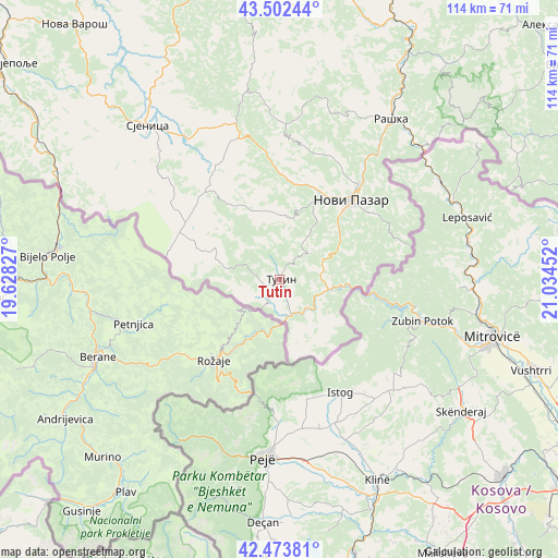
Tutin GPS coordinates[2]
42° 59' 25.008" North, 20° 19' 53.004" East
| Map corner | latitude | longitude |
|---|---|---|
| Upper-left | 43.50244°, | 19.62827° |
| Center: | 42.99028°, | 20.33139° |
| Lower-right: | 42.47381°, | 21.03452° |
| Map W x H: | 114.4×114.4 km | = 71.1×71.1mi |
| max Lat: | 46.1° ⇑93.9% North |
| Tutin: | 42.99028° |
| min Lat: | ⇓6.1% South 42.25846° |
| min Long | Tutin | max Long |
| 18.9276° | 20.33139° | 22.77556° |
| W 49.7%⇐ | ⇒50.3% E |
Elevation
Elevation of Tutin is 869 m = 2851 ft, and this is 692.6 m = 2272 ft above average elevation for this country.
| Max E: |
1421 m = 4662 ft | 2.3% |
| Tutin | 869 m 2851 ft | |
| Avg. | 176.4 m = 579 ft | |
Min E: |
49 m = 161 ft | 97.7% |
See also: Serbia elevation on elevation.city.
Geographical zone
Tutin is located in North temperate zone (between Tropic of Cancer and the Arctic Circle). Distance of this Northern Tropic circle is 2174.2 km =1351 mi to South.| Distance of | km | miles | from Tutin |
|---|---|---|---|
| North Pole | 5227 | 3247.9 | to North |
| Arctic Circle | 2621.1 | 1628.7 | to North |
| Tropic Cancer | 2174.2 | 1351 | to South |
| Equator | 4780.1 | 2970.2 | to South |


Nearby cities:
15 places around Tutin: (largest is in red/bold)
• Aleksandrovac
78.3 km =48.7 mi,  48°
48°
• Bace
86.1 km =53.5 mi,  72°
72°
• Blace
84.5 km =52.5 mi, 66°
• Brezovica
84.4 km =52.4 mi,  4°
4°
• Ivanjica
66.1 km =41.1 mi,  352°
352°
• Kuršumlija
78.3 km =48.7 mi,  77°
77°
• Nova Varoš
67.2 km =41.8 mi,  321°
321°
• Novi Pazar
21.9 km =13.6 mi,  42°
42°
• Osječenik
42.1 km =26.2 mi,  294°
294°
• Prijepolje
71 km =44.1 mi,  308°
308°
• Raška
40.3 km =25 mi,  34°
34°
• Sjenica
41.4 km =25.7 mi, 319°
• Sokolovica
25.1 km =15.6 mi,  357°
357°
• Sokolovo Brdo
45.7 km =28.4 mi, 290°
• Vrnjačka Banja
84.3 km =52.4 mi, 32°
Sources, notices
• [Note1] Compared only with cities in Serbia existing in our database
• [Src1] Map data: © OpenStreetMap contributors (CC-BY-SA)
• [Src2] Other city data from geonames.org with taken over terms of usage.
• [Src3] Geographical zone / Annual Mean Temperature by Robert A. Rohde @ Wikipedia
