Sokolovica geodata
Sokolovica (Central Serbia) is a populated place; located in Serbia in Europe/Belgrade (GMT+2) time zone. With population of 1,022 people, there are 315 cities with bigger population in this country. Compared to other cities in Serbia, 91.2% of cities are located further ↑North; 51.9% of cities are located further →East and 98.9% of cities have lower elevation than Sokolovica. Note1


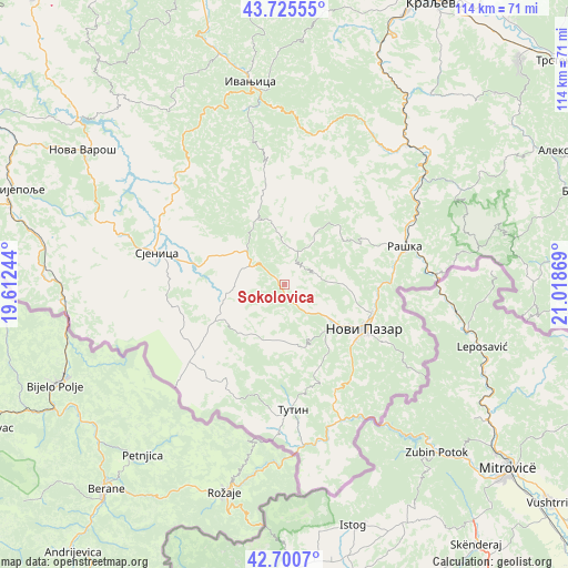
Sokolovica GPS coordinates[2]
43° 12' 55.008" North, 20° 18' 56.016" East
| Map corner | latitude | longitude |
|---|---|---|
| Upper-left | 43.72555°, | 19.61244° |
| Center: | 43.21528°, | 20.31556° |
| Lower-right: | 42.7007°, | 21.01869° |
| Map W x H: | 114×114 km | = 70.8×70.8mi |
| max Lat: | 46.1° ⇑91.2% North |
| Sokolovica: | 43.21528° |
| min Lat: | ⇓8.8% South 42.25846° |
| min Long | Sokolovica | max Long |
| 18.9276° | 20.31556° | 22.77556° |
| W 48.1%⇐ | ⇒51.9% E |
Elevation
Elevation of Sokolovica is 1000 m = 3281 ft, and this is 823.6 m = 2702 ft above average elevation for this country.
| Max E: |
1421 m = 4662 ft | 1.1% |
| Sokolovica | 1000 m 3281 ft | |
| Avg. | 176.4 m = 579 ft | |
Min E: |
49 m = 161 ft | 98.9% |
See also: Serbia elevation on elevation.city.
Geographical zone
Sokolovica is located in North temperate zone (between Tropic of Cancer and the Arctic Circle). Distance of this Northern Tropic circle is 2199.2 km =1366.5 mi to South.| Distance of | km | miles | from Sokolovica |
|---|---|---|---|
| North Pole | 5202 | 3232.4 | to North |
| Arctic Circle | 2596.1 | 1613.1 | to North |
| Tropic Cancer | 2199.2 | 1366.5 | to South |
| Equator | 4805.1 | 2985.7 | to South |


Nearby cities:
15 places around Sokolovica: (largest is in red/bold)
• Aleksandrovac
65.5 km =40.7 mi,  65°
65°
• Arilje
62.4 km =38.8 mi,  343°
343°
• Brezovica
59.6 km =37 mi,  7°
7°
• Ivanjica
41.2 km =25.6 mi,  350°
350°
• Kraljevo
64.3 km =40 mi,  27°
27°
• Nova Varoš
49.1 km =30.5 mi,  303°
303°
• Novi Pazar
18.2 km =11.3 mi,  118°
118°
• Osječenik
37.8 km =23.5 mi,  258°
258°
• Prijepolje
57.3 km =35.6 mi,  289°
289°
• Raška
25.6 km =15.9 mi, 71°
• Sjenica
26.4 km =16.4 mi,  284°
284°
• Sokolovo Brdo
42.3 km =26.3 mi, 258°
• Trstenik
71.2 km =44.2 mi,  51°
51°
• Tutin
25.1 km =15.6 mi,  177°
177°
• Vrnjačka Banja
65.6 km =40.8 mi, 45°
Sources, notices
• [Note1] Compared only with cities in Serbia existing in our database
• [Src1] Map data: © OpenStreetMap contributors (CC-BY-SA)
• [Src2] Other city data from geonames.org with taken over terms of usage.
• [Src3] Geographical zone / Annual Mean Temperature by Robert A. Rohde @ Wikipedia
