Lajkovac geodata
Lajkovac (Central Serbia) is a seat of a third-order administrative division; located in Serbia in Europe/Belgrade (GMT+2) time zone. In our database, there are 365 cities with bigger population. Compared to other cities in Serbia, 73.9% of cities are located further ↑North; 59.6% of cities are located further →East and 59.6% of cities have lower elevation than Lajkovac. Note1


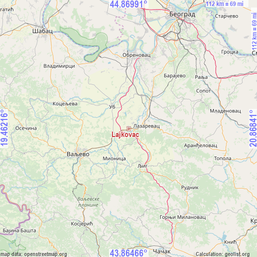
Lajkovac GPS coordinates[2]
44° 22' 9.984" North, 20° 9' 55.008" East
| Map corner | latitude | longitude |
|---|---|---|
| Upper-left | 44.86991°, | 19.46216° |
| Center: | 44.36944°, | 20.16528° |
| Lower-right: | 43.86466°, | 20.86841° |
| Map W x H: | 111.8×111.8 km | = 69.5×69.5mi |
| max Lat: | 46.1° ⇑73.9% North |
| Lajkovac: | 44.36944° |
| min Lat: | ⇓26.1% South 42.25846° |
| min Long | Lajkovac | max Long |
| 18.9276° | 20.16528° | 22.77556° |
| W 40.4%⇐ | ⇒59.6% E |
Elevation
Elevation of Lajkovac is 111 m = 364 ft, and this is 65.4 m = 215 ft below average elevation for this country.
| Max E: |
1421 m = 4662 ft | 40.4% |
| Avg. | 176.4 m = 579 ft | |
| Lajkovac | 111 m = 364 ft | |
Min E: |
49 m = 161 ft | 59.6% |
See also: Serbia elevation on elevation.city.
Geographical zone
Lajkovac is located in North temperate zone (between Tropic of Cancer and the Arctic Circle). Distance of this Northern Tropic circle is 2327.5 km =1446.2 mi to South.| Distance of | km | miles | from Lajkovac |
|---|---|---|---|
| North Pole | 5073.6 | 3152.6 | to North |
| Arctic Circle | 2467.8 | 1533.4 | to North |
| Tropic Cancer | 2327.5 | 1446.2 | to South |
| Equator | 4933.4 | 3065.5 | to South |


Nearby cities:
15 places around Lajkovac: (largest is in red/bold)
• Barajevo
30.6 km =19 mi,  40°
40°
• Gornja Bukovica
28.1 km =17.5 mi,  263°
263°
• Grabovac
26.5 km =16.5 mi,  346°
346°
• Koceljeva
30.4 km =18.9 mi,  292°
292°
• Lazarevac
7.4 km =4.6 mi,  76°
76°
• Ljig
16.5 km =10.3 mi,  159°
159°
• Mala Moštanica
31.9 km =19.8 mi,  20°
20°
• Mionica
14.7 km =9.1 mi,  206°
206°
• Obrenovac
31.9 km =19.8 mi,  4°
4°
• Stepojevac
19 km =11.8 mi,  32°
32°
• Stubline
23 km =14.3 mi, 353°
• Ub
12.1 km =7.5 mi,  323°
323°
• Valjevo
23.7 km =14.7 mi,  243°
243°
• Vranić
29 km =18 mi, 26°
• Zvečka
30.1 km =18.7 mi,  359°
359°
Sources, notices
• [Note1] Compared only with cities in Serbia existing in our database
• [Src1] Map data: © OpenStreetMap contributors (CC-BY-SA)
• [Src2] Other city data from geonames.org with taken over terms of usage.
• [Src3] Geographical zone / Annual Mean Temperature by Robert A. Rohde @ Wikipedia
