Batočina geodata
Batočina (Central Serbia) is a seat of a third-order administrative division; located in Serbia in Europe/Belgrade (GMT+2) time zone. In our database, there are 365 cities with bigger population. Compared to other cities in Serbia, 78% of cities are located further ↑North; 76.9% of cities are located further ←West and 58.5% of cities have lower elevation than Batočina. Note1


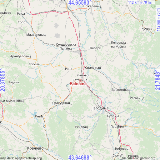
Batočina GPS coordinates[2]
44° 9' 12.996" North, 21° 4' 54.012" East
| Map corner | latitude | longitude |
|---|---|---|
| Upper-left | 44.65593°, | 20.37855° |
| Center: | 44.15361°, | 21.08167° |
| Lower-right: | 43.64698°, | 21.7848° |
| Map W x H: | 112.2×112.2 km | = 69.7×69.7mi |
| max Lat: | 46.1° ⇑78% North |
| Batočina: | 44.15361° |
| min Lat: | ⇓22% South 42.25846° |
| min Long | Batočina | max Long |
| 18.9276° | 21.08167° | 22.77556° |
| W 76.9%⇐ | ⇒23.1% E |
Elevation
Elevation of Batočina is 109 m = 358 ft, and this is 67.4 m = 221 ft below average elevation for this country.
| Max E: |
1421 m = 4662 ft | 41.5% |
| Avg. | 176.4 m = 579 ft | |
| Batočina | 109 m = 358 ft | |
Min E: |
49 m = 161 ft | 58.5% |
See also: Serbia elevation on elevation.city.
Geographical zone
Batočina is located in North temperate zone (between Tropic of Cancer and the Arctic Circle). Distance of this Northern Tropic circle is 2303.5 km =1431.3 mi to South.| Distance of | km | miles | from Batočina |
|---|---|---|---|
| North Pole | 5097.6 | 3167.5 | to North |
| Arctic Circle | 2491.8 | 1548.3 | to North |
| Tropic Cancer | 2303.5 | 1431.3 | to South |
| Equator | 4909.4 | 3050.6 | to South |


Nearby cities:
15 places around Batočina: (largest is in red/bold)
• Despotovac
29.9 km =18.6 mi,  103°
103°
• Glogovac
22.3 km =13.9 mi,  123°
123°
• Jagodina
24.3 km =15.1 mi,  143°
143°
• Knić
38.4 km =23.9 mi,  229°
229°
• Kragujevac
20.1 km =12.5 mi,  220°
220°
• Lapovo
3.6 km =2.2 mi,  20°
20°
• Petrovac
36.6 km =22.7 mi,  47°
47°
• Rača
11.7 km =7.3 mi,  314°
314°
• Rekovac
32.3 km =20.1 mi,  178°
178°
• Smederevska Palanka
25.5 km =15.8 mi,  337°
337°
• Svilajnac
12.8 km =8 mi, 45°
• Topola
33.7 km =20.9 mi,  289°
289°
• Velika Plana
20 km =12.4 mi,  358°
358°
• Ćuprija
34.1 km =21.2 mi, 137°
• Žabari
24.9 km =15.5 mi,  25°
25°
Sources, notices
• [Note1] Compared only with cities in Serbia existing in our database
• [Src1] Map data: © OpenStreetMap contributors (CC-BY-SA)
• [Src2] Other city data from geonames.org with taken over terms of usage.
• [Src3] Geographical zone / Annual Mean Temperature by Robert A. Rohde @ Wikipedia
