Yaroslavskiy geodata
Yaroslavskiy (Primorskiy (Maritime) Kray) is a populated place; located in Russia in Asia/Vladivostok (GMT+10) time zone. With population of 10,010 people, there are 1505 cities with bigger population in this country. Compared to other cities in Russia, 90.9% of cities are located further ↑North; 95.5% of cities are located further ←West and 61.4% of cities have higher elevation than Yaroslavskiy. Note1


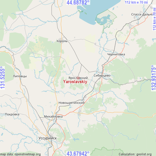
Yaroslavskiy GPS coordinates[2]
44° 11' 8.808" North, 132° 13' 43.032" East
| Map corner | latitude | longitude |
|---|---|---|
| Upper-left | 44.68782°, | 131.5255° |
| Center: | 44.18578°, | 132.22862° |
| Lower-right: | 43.67942°, | 132.93175° |
| Map W x H: | 112.1×112.1 km | = 69.7×69.7mi |
| max Lat: | 73.50819° ⇑90.9% North |
| Yaroslavskiy: | 44.18578° |
| min Lat: | ⇓9.1% South 41.28413° |
| min Long | Yaroslavskiy | max Long |
| -179.12198° | 132.22862° | 179.35046° |
| W 95.5%⇐ | ⇒4.5% E |
Elevation
Elevation of Yaroslavskiy is 121 m = 397 ft, and this is 81.6 m = 268 ft below average elevation for this country.
| Max E: |
2518 m = 8261 ft | 61.4% |
| Avg. | 202.6 m = 665 ft | |
| Yaroslavskiy | 121 m = 397 ft | |
Min E: |
-28 m = -92 ft | 38.6% |
See also: Russia elevation on elevation.city.
Geographical zone
Yaroslavskiy is located in North temperate zone (between Tropic of Cancer and the Arctic Circle). Distance of this Northern Tropic circle is 2307.1 km =1433.6 mi to South.| Distance of | km | miles | from Yaroslavskiy |
|---|---|---|---|
| North Pole | 5094.1 | 3165.3 | to North |
| Arctic Circle | 2488.2 | 1546.1 | to North |
| Tropic Cancer | 2307.1 | 1433.6 | to South |
| Equator | 4913 | 3052.8 | to South |


Nearby cities:
15 places around Yaroslavskiy: (largest is in red/bold)
• Blagodatnoye
18.8 km =11.7 mi,  324°
324°
• Chernigovka
32.2 km =20 mi,  57°
57°
• Grigor’yevka
18.9 km =11.7 mi,  261°
261°
• Ivanovka
31.6 km =19.6 mi,  139°
139°
• Khorol’
29.4 km =18.3 mi,  335°
335°
• Lipovtsy
40.3 km =25 mi,  272°
272°
• Luchki
11.4 km =7.1 mi,  12°
12°
• Lyalichi
17.9 km =11.1 mi,  134°
134°
• Mikhaylovka
33.1 km =20.6 mi,  211°
211°
• Monastyrishche
21.8 km =13.5 mi,  86°
86°
• Novonikol’sk
47 km =29.2 mi,  218°
218°
• Novoshakhtinskiy
18.5 km =11.5 mi,  195°
195°
• Rettikhovka
43.3 km =26.9 mi, 92°
• Sivakovka
34.3 km =21.3 mi,  18°
18°
• Vozdvizhenka
39.5 km =24.5 mi, 214°
Sources, notices
• [Note1] Compared only with cities in Russia existing in our database
• [Src1] Map data: © OpenStreetMap contributors (CC-BY-SA)
• [Src2] Other city data from geonames.org with taken over terms of usage.
• [Src3] Geographical zone / Annual Mean Temperature by Robert A. Rohde @ Wikipedia
