Chernigovka geodata
Chernigovka (Primorskiy (Maritime) Kray) is a populated place; located in Russia in Asia/Vladivostok (GMT+10) time zone. With population of 13,969 people, there are 1143 cities with bigger population in this country. Compared to other cities in Russia, 90% of cities are located further ↑North; 95.8% of cities are located further ←West and 76.7% of cities have higher elevation than Chernigovka. Note1


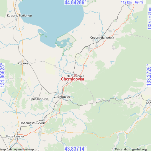
Chernigovka GPS coordinates[2]
44° 20' 31.776" North, 132° 34' 9.732" East
| Map corner | latitude | longitude |
|---|---|---|
| Upper-left | 44.84286°, | 131.86625° |
| Center: | 44.34216°, | 132.56937° |
| Lower-right: | 43.83714°, | 133.2725° |
| Map W x H: | 111.8×111.8 km | = 69.5×69.5mi |
| max Lat: | 73.50819° ⇑90% North |
| Chernigovka: | 44.34216° |
| min Lat: | ⇓10% South 41.28413° |
| min Long | Chernigovka | max Long |
| -179.12198° | 132.56937° | 179.35046° |
| W 95.8%⇐ | ⇒4.2% E |
Elevation
Elevation of Chernigovka is 82 m = 269 ft, and this is 120.6 m = 396 ft below average elevation for this country.
| Max E: |
2518 m = 8261 ft | 76.7% |
| Avg. | 202.6 m = 665 ft | |
| Chernigovka | 82 m = 269 ft | |
Min E: |
-28 m = -92 ft | 23.3% |
See also: Russia elevation on elevation.city.
Geographical zone
Chernigovka is located in North temperate zone (between Tropic of Cancer and the Arctic Circle). Distance of this Northern Tropic circle is 2324.5 km =1444.4 mi to South.| Distance of | km | miles | from Chernigovka |
|---|---|---|---|
| North Pole | 5076.7 | 3154.5 | to North |
| Arctic Circle | 2470.8 | 1535.3 | to North |
| Tropic Cancer | 2324.5 | 1444.4 | to South |
| Equator | 4930.4 | 3063.6 | to South |


Nearby cities:
15 places around Chernigovka: (largest is in red/bold)
• Blagodatnoye
38.1 km =23.7 mi,  266°
266°
• Chernyshëvka
47.5 km =29.5 mi,  109°
109°
• Grazhdanka
50.4 km =31.3 mi, 106°
• Grigor’yevka
50 km =31.1 mi,  246°
246°
• Ivanovka
42.1 km =26.2 mi,  189°
189°
• Khorol’
40.3 km =25 mi,  283°
283°
• Luchki
25.4 km =15.8 mi,  255°
255°
• Lyalichi
33.1 km =20.6 mi,  205°
205°
• Monastyrishche
17.1 km =10.6 mi,  198°
198°
• Novoshakhtinskiy
47.7 km =29.6 mi,  222°
222°
• Rettikhovka
24.9 km =15.5 mi,  139°
139°
• Sivakovka
22.1 km =13.7 mi,  313°
313°
• Spassk-Dal’niy
35.1 km =21.8 mi,  35°
35°
• Spasskoye
35.2 km =21.9 mi,  31°
31°
• Yaroslavskiy
32.2 km =20 mi,  237°
237°
Sources, notices
• [Note1] Compared only with cities in Russia existing in our database
• [Src1] Map data: © OpenStreetMap contributors (CC-BY-SA)
• [Src2] Other city data from geonames.org with taken over terms of usage.
• [Src3] Geographical zone / Annual Mean Temperature by Robert A. Rohde @ Wikipedia
