Sivakovka geodata
Sivakovka (Primorskiy (Maritime) Kray) is a populated place; located in Russia in Asia/Vladivostok (GMT+10) time zone. With population of 1,503 people, there are 4371 cities with bigger population in this country. Compared to other cities in Russia, 89.5% of cities are located further ↑North; 95.6% of cities are located further ←West and 79.6% of cities have higher elevation than Sivakovka. Note1


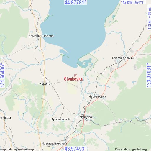
Sivakovka GPS coordinates[2]
44° 28' 42.168" North, 132° 22' 1.848" East
| Map corner | latitude | longitude |
|---|---|---|
| Upper-left | 44.97791°, | 131.66406° |
| Center: | 44.47838°, | 132.36718° |
| Lower-right: | 43.97453°, | 133.07031° |
| Map W x H: | 111.6×111.6 km | = 69.3×69.3mi |
| max Lat: | 73.50819° ⇑89.5% North |
| Sivakovka: | 44.47838° |
| min Lat: | ⇓10.5% South 41.28413° |
| min Long | Sivakovka | max Long |
| -179.12198° | 132.36718° | 179.35046° |
| W 95.6%⇐ | ⇒4.4% E |
Elevation
Elevation of Sivakovka is 72 m = 236 ft, and this is 130.6 m = 428 ft below average elevation for this country.
| Max E: |
2518 m = 8261 ft | 79.6% |
| Avg. | 202.6 m = 665 ft | |
| Sivakovka | 72 m = 236 ft | |
Min E: |
-28 m = -92 ft | 20.4% |
See also: Russia elevation on elevation.city.
Geographical zone
Sivakovka is located in North temperate zone (between Tropic of Cancer and the Arctic Circle). Distance of this Northern Tropic circle is 2339.6 km =1453.8 mi to South.| Distance of | km | miles | from Sivakovka |
|---|---|---|---|
| North Pole | 5061.5 | 3145.1 | to North |
| Arctic Circle | 2455.6 | 1525.8 | to North |
| Tropic Cancer | 2339.6 | 1453.8 | to South |
| Equator | 4945.5 | 3073 | to South |


Nearby cities:
15 places around Sivakovka: (largest is in red/bold)
• Blagodatnoye
28 km =17.4 mi,  231°
231°
• Chernigovka
22.1 km =13.7 mi,  133°
133°
• Grigor’yevka
46.1 km =28.6 mi,  220°
220°
• Kamen’-Rybolov
39 km =24.2 mi,  319°
319°
• Khorol’
23.8 km =14.8 mi,  255°
255°
• Luchki
23 km =14.3 mi,  201°
201°
• Lyalichi
45.1 km =28 mi,  177°
177°
• Mel’gunovka
35.2 km =21.9 mi,  287°
287°
• Monastyrishche
33.1 km =20.6 mi,  161°
161°
• Novoshakhtinskiy
52.8 km =32.8 mi, 197°
• Rettikhovka
46.9 km =29.1 mi,  136°
136°
• Spassk-Dal’niy
38.7 km =24 mi,  69°
69°
• Spasskoye
37.4 km =23.2 mi, 66°
• Yaroslavskiy
34.3 km =21.3 mi, 198°
• Zharikovo
52.1 km =32.4 mi,  283°
283°
Sources, notices
• [Note1] Compared only with cities in Russia existing in our database
• [Src1] Map data: © OpenStreetMap contributors (CC-BY-SA)
• [Src2] Other city data from geonames.org with taken over terms of usage.
• [Src3] Geographical zone / Annual Mean Temperature by Robert A. Rohde @ Wikipedia
