Baley geodata
Baley (Transbaikal Territory) is a populated place; located in Russia in Asia/Chita (GMT+9) time zone. With population of 13,404 people, there are 1176 cities with bigger population in this country. Compared to other cities in Russia, 72% of cities are located further ↑North; 92.5% of cities are located further ←West and 95.1% of cities have lower elevation than Baley. Note1


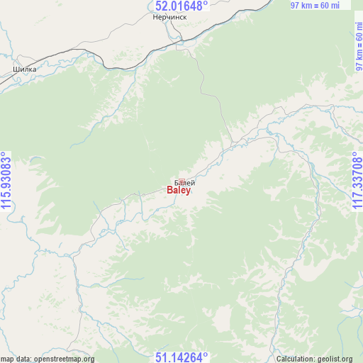
Baley GPS coordinates[2]
51° 34' 53.976" North, 116° 38' 2.22" East
| Map corner | latitude | longitude |
|---|---|---|
| Upper-left | 52.01648°, | 115.93083° |
| Center: | 51.58166°, | 116.63395° |
| Lower-right: | 51.14264°, | 117.33708° |
| Map W x H: | 97.2×97.2 km | = 60.4×60.4mi |
| max Lat: | 73.50819° ⇑72% North |
| Baley: | 51.58166° |
| min Lat: | ⇓28% South 41.28413° |
| min Long | Baley | max Long |
| -179.12198° | 116.63395° | 179.35046° |
| W 92.5%⇐ | ⇒7.5% E |
Elevation
Elevation of Baley is 640 m = 2100 ft, and this is 437.4 m = 1435 ft above average elevation for this country.
| Max E: |
2518 m = 8261 ft | 4.9% |
| Baley | 640 m 2100 ft | |
| Avg. | 202.6 m = 665 ft | |
Min E: |
-28 m = -92 ft | 95.1% |
See also: Russia elevation on elevation.city.
Geographical zone
Baley is located in North temperate zone (between Tropic of Cancer and the Arctic Circle). Distance of this North polar circle is 1665.8 km =1035.1 mi to North.| Distance of | km | miles | from Baley |
|---|---|---|---|
| North Pole | 4271.7 | 2654.3 | to North |
| Arctic Circle | 1665.8 | 1035.1 | to North |
| Tropic Cancer | 3129.4 | 1944.5 | to South |
| Equator | 5735.3 | 3563.7 | to South |


Nearby cities:
15 places around Baley: (largest is in red/bold)
• Aleksandrovskiy Zavod
116.4 km =72.3 mi,  128°
128°
• Arbagar
47.2 km =29.3 mi,  325°
325°
• Chernyshevsk
107.8 km =67 mi,  14°
14°
• Kalanguy
63.3 km =39.3 mi,  187°
187°
• Kholbon
42.7 km =26.5 mi,  321°
321°
• Kokuy
93.9 km =58.3 mi,  42°
42°
• Nerchinsk
44.8 km =27.8 mi,  355°
355°
• Olovyannaya
102.2 km =63.5 mi,  226°
226°
• Pervomayskiy
70.3 km =43.7 mi,  278°
278°
• Priiskovyy
39.1 km =24.3 mi, 359°
• Shelopugino
64.6 km =40.1 mi,  82°
82°
• Shilka
51 km =31.7 mi,  305°
305°
• Sretensk
104.5 km =64.9 mi, 44°
• Vershino-Darasunskiy
115.6 km =71.8 mi, 318°
• Vershino-Shakhtaminskiy
92.3 km =57.4 mi,  109°
109°
Sources, notices
• [Note1] Compared only with cities in Russia existing in our database
• [Src1] Map data: © OpenStreetMap contributors (CC-BY-SA)
• [Src2] Other city data from geonames.org with taken over terms of usage.
• [Src3] Geographical zone / Annual Mean Temperature by Robert A. Rohde @ Wikipedia
