Kalga geodata
Kalga (Transbaikal Territory) is a populated place; located in Russia in Asia/Chita (GMT+9) time zone. With population of 3,573 people, there are 3356 cities with bigger population in this country. Compared to other cities in Russia, 75.2% of cities are located further ↑North; 92.9% of cities are located further ←West and 94.9% of cities have lower elevation than Kalga. Note1


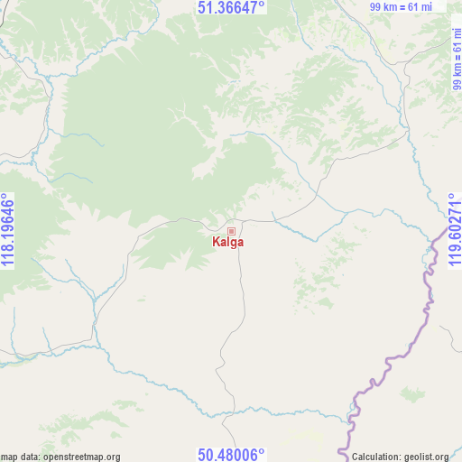
Kalga GPS coordinates[2]
50° 55' 31.368" North, 118° 53' 58.488" East
| Map corner | latitude | longitude |
|---|---|---|
| Upper-left | 51.36647°, | 118.19646° |
| Center: | 50.92538°, | 118.89958° |
| Lower-right: | 50.48006°, | 119.60271° |
| Map W x H: | 98.6×98.6 km | = 61.3×61.3mi |
| max Lat: | 73.50819° ⇑75.2% North |
| Kalga: | 50.92538° |
| min Lat: | ⇓24.8% South 41.28413° |
| min Long | Kalga | max Long |
| -179.12198° | 118.89958° | 179.35046° |
| W 92.9%⇐ | ⇒7.1% E |
Elevation
Elevation of Kalga is 628 m = 2060 ft, and this is 425.4 m = 1396 ft above average elevation for this country.
| Max E: |
2518 m = 8261 ft | 5.1% |
| Kalga | 628 m 2060 ft | |
| Avg. | 202.6 m = 665 ft | |
Min E: |
-28 m = -92 ft | 94.9% |
See also: Russia elevation on elevation.city.
Geographical zone
Kalga is located in North temperate zone (between Tropic of Cancer and the Arctic Circle). Distance of this North polar circle is 1738.8 km =1080.4 mi to North.| Distance of | km | miles | from Kalga |
|---|---|---|---|
| North Pole | 4344.7 | 2699.7 | to North |
| Arctic Circle | 1738.8 | 1080.4 | to North |
| Tropic Cancer | 3056.5 | 1899.2 | to South |
| Equator | 5662.4 | 3518.5 | to South |


Nearby cities:
15 places around Kalga: (largest is in red/bold)
• Abagaytuy
167.4 km =104 mi,  206°
206°
• Aleksandrovskiy Zavod
67.4 km =41.9 mi,  269°
269°
• Baley
173.7 km =107.9 mi,  294°
294°
• Borzya
178.5 km =110.9 mi,  250°
250°
• Gazimurskiy Zavod
79.8 km =49.6 mi,  331°
331°
• Kadaya
27.7 km =17.2 mi,  88°
88°
• Kalanguy
167.1 km =103.8 mi, 273°
• Klichka
83 km =51.6 mi,  230°
230°
• Kokuy
170.1 km =105.7 mi, 326°
• Krasnokamensk
110.4 km =68.6 mi, 213°
• Nerchinskiy Zavod
65.7 km =40.8 mi,  49°
49°
• Priargunsk
63.5 km =39.5 mi,  167°
167°
• Shelopugino
123.2 km =76.6 mi,  311°
311°
• Sretensk
168.5 km =104.7 mi, 330°
• Vershino-Shakhtaminskiy
82 km =51 mi,  300°
300°
Sources, notices
• [Note1] Compared only with cities in Russia existing in our database
• [Src1] Map data: © OpenStreetMap contributors (CC-BY-SA)
• [Src2] Other city data from geonames.org with taken over terms of usage.
• [Src3] Geographical zone / Annual Mean Temperature by Robert A. Rohde @ Wikipedia
