Terney geodata
Terney (Primorskiy (Maritime) Kray) is a populated place; located in Russia in Asia/Vladivostok (GMT+10) time zone. With population of 3,876 people, there are 3181 cities with bigger population in this country. Compared to other cities in Russia, 87.1% of cities are located further ↑North; 97.4% of cities are located further ←West and 96.8% of cities have higher elevation than Terney. Note1


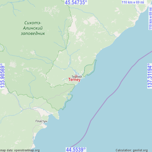
Terney GPS coordinates[2]
45° 3' 10.008" North, 136° 36' 31.716" East
| Map corner | latitude | longitude |
|---|---|---|
| Upper-left | 45.54735°, | 135.90569° |
| Center: | 45.05278°, | 136.60881° |
| Lower-right: | 44.5539°, | 137.31194° |
| Map W x H: | 110.5×110.5 km | = 68.7×68.7mi |
| max Lat: | 73.50819° ⇑87.1% North |
| Terney: | 45.05278° |
| min Lat: | ⇓12.9% South 41.28413° |
| min Long | Terney | max Long |
| -179.12198° | 136.60881° | 179.35046° |
| W 97.4%⇐ | ⇒2.6% E |
Elevation
Elevation of Terney is 8 m = 26 ft, and this is 194.6 m = 638 ft below average elevation for this country.
| Max E: |
2518 m = 8261 ft | 96.8% |
| Avg. | 202.6 m = 665 ft | |
| Terney | 8 m = 26 ft | |
Min E: |
-28 m = -92 ft | 3.2% |
See also: Russia elevation on elevation.city.
Geographical zone
Terney is located in North temperate zone (between Tropic of Cancer and the Arctic Circle). Distance of this North polar circle is 2391.8 km =1486.2 mi to North.| Distance of | km | miles | from Terney |
|---|---|---|---|
| North Pole | 4997.7 | 3105.4 | to North |
| Arctic Circle | 2391.8 | 1486.2 | to North |
| Tropic Cancer | 2403.5 | 1493.5 | to South |
| Equator | 5009.4 | 3112.7 | to South |


Nearby cities:
15 places around Terney: (largest is in red/bold)
• Chuguyevka
238.5 km =148.2 mi,  245°
245°
• Dalnegorsk
95.4 km =59.3 mi,  234°
234°
• Dalnerechensk
244.1 km =151.7 mi,  293°
293°
• Gornorechenskiy
147.1 km =91.4 mi, 233°
• Kamenka
81.1 km =50.4 mi,  215°
215°
• Kavalerovo
150.6 km =93.6 mi, 234°
• Kirovskiy
244.1 km =151.7 mi,  271°
271°
• Krasnorechenskiy
109.7 km =68.2 mi,  244°
244°
• Novopokrovka
187 km =116.2 mi,  298°
298°
• Ol’ga
179 km =111.2 mi, 215°
• Plastun
41.5 km =25.8 mi, 218°
• Rudnaya Pristan’
99.5 km =61.8 mi, 219°
• Rudnyy
156.2 km =97.1 mi, 236°
• Svetlaya
212.6 km =132.1 mi,  38°
38°
• Vostok
166.9 km =103.7 mi,  338°
338°
Sources, notices
• [Note1] Compared only with cities in Russia existing in our database
• [Src1] Map data: © OpenStreetMap contributors (CC-BY-SA)
• [Src2] Other city data from geonames.org with taken over terms of usage.
• [Src3] Geographical zone / Annual Mean Temperature by Robert A. Rohde @ Wikipedia
