Plastun geodata
Plastun (Primorskiy (Maritime) Kray) is a populated place; located in Russia in Asia/Vladivostok (GMT+10) time zone. With population of 6,082 people, there are 2231 cities with bigger population in this country. Compared to other cities in Russia, 88.5% of cities are located further ↑North; 97.3% of cities are located further ←West and 89.2% of cities have higher elevation than Plastun. Note1


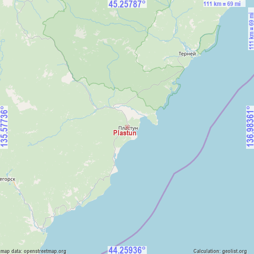
Plastun GPS coordinates[2]
44° 45' 38.772" North, 136° 16' 49.728" East
| Map corner | latitude | longitude |
|---|---|---|
| Upper-left | 45.25787°, | 135.57736° |
| Center: | 44.76077°, | 136.28048° |
| Lower-right: | 44.25936°, | 136.98361° |
| Map W x H: | 111×111 km | = 69×69mi |
| max Lat: | 73.50819° ⇑88.5% North |
| Plastun: | 44.76077° |
| min Lat: | ⇓11.5% South 41.28413° |
| min Long | Plastun | max Long |
| -179.12198° | 136.28048° | 179.35046° |
| W 97.3%⇐ | ⇒2.7% E |
Elevation
Elevation of Plastun is 31 m = 102 ft, and this is 171.6 m = 563 ft below average elevation for this country.
| Max E: |
2518 m = 8261 ft | 89.2% |
| Avg. | 202.6 m = 665 ft | |
| Plastun | 31 m = 102 ft | |
Min E: |
-28 m = -92 ft | 10.8% |
See also: Russia elevation on elevation.city.
Geographical zone
Plastun is located in North temperate zone (between Tropic of Cancer and the Arctic Circle). Distance of this Northern Tropic circle is 2371 km =1473.3 mi to South.| Distance of | km | miles | from Plastun |
|---|---|---|---|
| North Pole | 5030.1 | 3125.6 | to North |
| Arctic Circle | 2424.2 | 1506.3 | to North |
| Tropic Cancer | 2371 | 1473.3 | to South |
| Equator | 4976.9 | 3092.5 | to South |


Nearby cities:
15 places around Plastun: (largest is in red/bold)
• Chuguyevka
202.7 km =126 mi,  250°
250°
• Dalnegorsk
56.9 km =35.4 mi, 246°
• Gornorechenskiy
107.6 km =66.9 mi,  239°
239°
• Gornyye Klyuchi
224.6 km =139.6 mi,  283°
283°
• Kamenka
39.7 km =24.7 mi,  212°
212°
• Kavalerovo
111.5 km =69.3 mi, 240°
• Kirovskiy
221.9 km =137.9 mi, 279°
• Krasnorechenskiy
74.8 km =46.5 mi,  258°
258°
• Novopokrovka
184.7 km =114.8 mi,  311°
311°
• Ol’ga
137.5 km =85.4 mi, 214°
• Rudnaya Pristan’
58 km =36 mi,  219°
219°
• Rudnyy
117.6 km =73.1 mi, 242°
• Terney
41.5 km =25.8 mi,  38°
38°
• Vostok
191.3 km =118.9 mi,  349°
349°
• Yakovlevka
225.3 km =140 mi, 260°
Sources, notices
• [Note1] Compared only with cities in Russia existing in our database
• [Src1] Map data: © OpenStreetMap contributors (CC-BY-SA)
• [Src2] Other city data from geonames.org with taken over terms of usage.
• [Src3] Geographical zone / Annual Mean Temperature by Robert A. Rohde @ Wikipedia
