Gornorechenskiy geodata
Gornorechenskiy (Primorskiy (Maritime) Kray) is a populated place; located in Russia in Asia/Vladivostok (GMT+10) time zone. With population of 3,409 people, there are 3464 cities with bigger population in this country. Compared to other cities in Russia, 90.3% of cities are located further ↑North; 96.9% of cities are located further ←West and 65% of cities have lower elevation than Gornorechenskiy. Note1


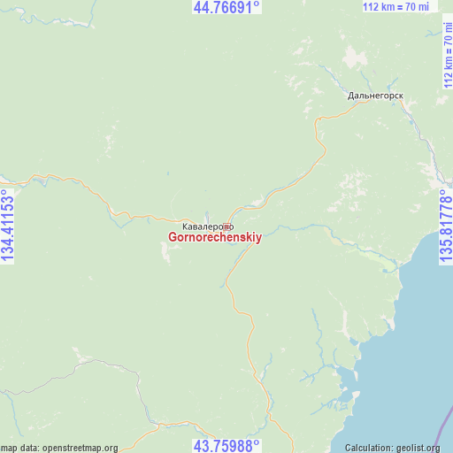
Gornorechenskiy GPS coordinates[2]
44° 15' 55.98" North, 135° 6' 52.74" East
| Map corner | latitude | longitude |
|---|---|---|
| Upper-left | 44.76691°, | 134.41153° |
| Center: | 44.26555°, | 135.11465° |
| Lower-right: | 43.75988°, | 135.81778° |
| Map W x H: | 112×112 km | = 69.6×69.6mi |
| max Lat: | 73.50819° ⇑90.3% North |
| Gornorechenskiy: | 44.26555° |
| min Lat: | ⇓9.7% South 41.28413° |
| min Long | Gornorechenskiy | max Long |
| -179.12198° | 135.11465° | 179.35046° |
| W 96.9%⇐ | ⇒3.1% E |
Elevation
Elevation of Gornorechenskiy is 182 m = 597 ft, and this is 20.6 m = 68 ft below average elevation for this country.
| Max E: |
2518 m = 8261 ft | 35% |
| Avg. | 202.6 m = 665 ft | |
| Gornorechenskiy | 182 m = 597 ft | |
Min E: |
-28 m = -92 ft | 65% |
See also: Russia elevation on elevation.city.
Geographical zone
Gornorechenskiy is located in North temperate zone (between Tropic of Cancer and the Arctic Circle). Distance of this Northern Tropic circle is 2315.9 km =1439 mi to South.| Distance of | km | miles | from Gornorechenskiy |
|---|---|---|---|
| North Pole | 5085.2 | 3159.8 | to North |
| Arctic Circle | 2479.3 | 1540.6 | to North |
| Tropic Cancer | 2315.9 | 1439 | to South |
| Equator | 4921.9 | 3058.3 | to South |


Nearby cities:
15 places around Gornorechenskiy: (largest is in red/bold)
• Arsen’yev
146.9 km =91.3 mi,  265°
265°
• Chuguyevka
100.2 km =62.3 mi,  263°
263°
• Dalnegorsk
51.7 km =32.1 mi,  51°
51°
• Dostoyevka
130.2 km =80.9 mi, 272°
• Kamenka
74.6 km =46.4 mi,  73°
73°
• Kavalerovo
5 km =3.1 mi,  278°
278°
• Krasnorechenskiy
44.5 km =27.7 mi,  25°
25°
• Lazo
137.7 km =85.6 mi,  224°
224°
• Novosysoyevka
139.5 km =86.7 mi, 268°
• Ol’ga
59.3 km =36.8 mi,  166°
166°
• Plastun
107.6 km =66.9 mi,  59°
59°
• Rudnaya Pristan’
56.6 km =35.2 mi,  79°
79°
• Rudnyy
12.3 km =7.6 mi, 276°
• Terney
147.1 km =91.4 mi, 53°
• Yakovlevka
131.7 km =81.8 mi, 277°
Sources, notices
• [Note1] Compared only with cities in Russia existing in our database
• [Src1] Map data: © OpenStreetMap contributors (CC-BY-SA)
• [Src2] Other city data from geonames.org with taken over terms of usage.
• [Src3] Geographical zone / Annual Mean Temperature by Robert A. Rohde @ Wikipedia
