Ol’ga geodata
Ol’ga (Primorskiy (Maritime) Kray) is a populated place; located in Russia in Asia/Vladivostok (GMT+10) time zone. With population of 4,328 people, there are 2938 cities with bigger population in this country. Compared to other cities in Russia, 92.8% of cities are located further ↑North; 97% of cities are located further ←West and 94.5% of cities have higher elevation than Ol’ga. Note1


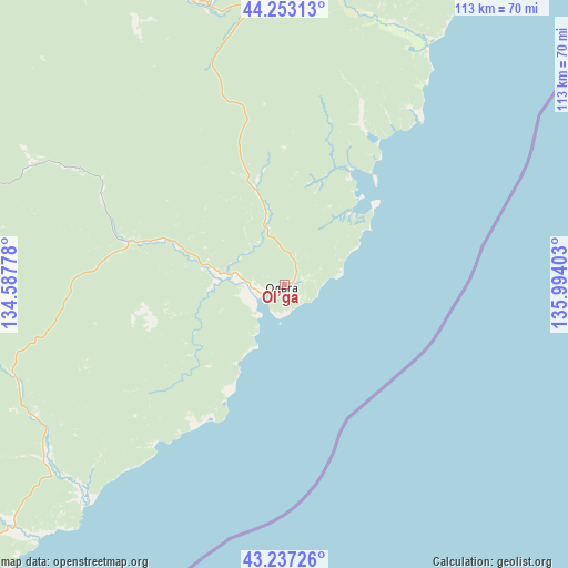
Ol’ga GPS coordinates[2]
43° 44' 50.46" North, 135° 17' 27.24" East
| Map corner | latitude | longitude |
|---|---|---|
| Upper-left | 44.25313°, | 134.58778° |
| Center: | 43.74735°, | 135.2909° |
| Lower-right: | 43.23726°, | 135.99403° |
| Map W x H: | 113×113 km | = 70.2×70.2mi |
| max Lat: | 73.50819° ⇑92.8% North |
| Ol’ga: | 43.74735° |
| min Lat: | ⇓7.2% South 41.28413° |
| min Long | Ol’ga | max Long |
| -179.12198° | 135.2909° | 179.35046° |
| W 97%⇐ | ⇒3% E |
Elevation
Elevation of Ol’ga is 14 m = 46 ft, and this is 188.6 m = 619 ft below average elevation for this country.
| Max E: |
2518 m = 8261 ft | 94.5% |
| Avg. | 202.6 m = 665 ft | |
| Ol’ga | 14 m = 46 ft | |
Min E: |
-28 m = -92 ft | 5.5% |
See also: Russia elevation on elevation.city.
Geographical zone
Ol’ga is located in North temperate zone (between Tropic of Cancer and the Arctic Circle). Distance of this Northern Tropic circle is 2258.3 km =1403.2 mi to South.| Distance of | km | miles | from Ol’ga |
|---|---|---|---|
| North Pole | 5142.8 | 3195.6 | to North |
| Arctic Circle | 2536.9 | 1576.4 | to North |
| Tropic Cancer | 2258.3 | 1403.2 | to South |
| Equator | 4864.2 | 3022.5 | to South |


Nearby cities:
15 places around Ol’ga: (largest is in red/bold)
• Chuguyevka
123.3 km =76.6 mi,  292°
292°
• Dalnegorsk
93.8 km =58.3 mi,  16°
16°
• Dostoyevka
158.3 km =98.4 mi, 293°
• Gornorechenskiy
59.3 km =36.8 mi,  346°
346°
• Kamenka
97.9 km =60.8 mi,  36°
36°
• Kavalerovo
61.4 km =38.2 mi,  341°
341°
• Krasnorechenskiy
98.1 km =61 mi,  2°
2°
• Lazo
118.6 km =73.7 mi,  250°
250°
• Novosysoyevka
163.4 km =101.5 mi, 289°
• Plastun
137.5 km =85.4 mi,  34°
34°
• Preobrazheniye
146.4 km =91 mi,  230°
230°
• Rudnaya Pristan’
79.8 km =49.6 mi, 31°
• Rudnyy
64.6 km =40.1 mi, 335°
• Sergeyevka
161.8 km =100.5 mi, 254°
• Yakovlevka
163.5 km =101.6 mi,  297°
297°
Sources, notices
• [Note1] Compared only with cities in Russia existing in our database
• [Src1] Map data: © OpenStreetMap contributors (CC-BY-SA)
• [Src2] Other city data from geonames.org with taken over terms of usage.
• [Src3] Geographical zone / Annual Mean Temperature by Robert A. Rohde @ Wikipedia
