Makkaveyevo geodata
Makkaveyevo (Transbaikal Territory) is a populated place; located in Russia in Asia/Chita (GMT+9) time zone. With population of 3,922 people, there are 3157 cities with bigger population in this country. Compared to other cities in Russia, 70.8% of cities are located further ↑North; 91.9% of cities are located further ←West and 94.7% of cities have lower elevation than Makkaveyevo. Note1


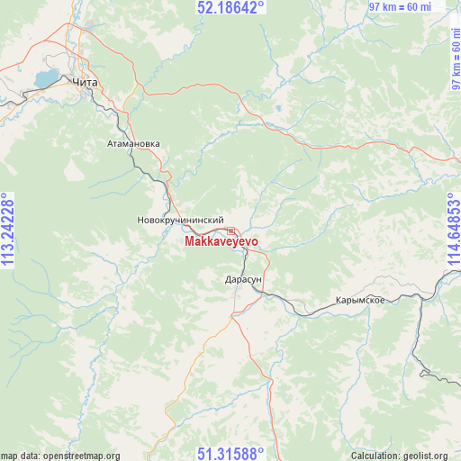
Makkaveyevo GPS coordinates[2]
51° 45' 11.7" North, 113° 56' 43.44" East
| Map corner | latitude | longitude |
|---|---|---|
| Upper-left | 52.18642°, | 113.24228° |
| Center: | 51.75325°, | 113.9454° |
| Lower-right: | 51.31588°, | 114.64853° |
| Map W x H: | 96.8×96.8 km | = 60.1×60.1mi |
| max Lat: | 73.50819° ⇑70.8% North |
| Makkaveyevo: | 51.75325° |
| min Lat: | ⇓29.2% South 41.28413° |
| min Long | Makkaveyevo | max Long |
| -179.12198° | 113.9454° | 179.35046° |
| W 91.9%⇐ | ⇒8.1% E |
Elevation
Elevation of Makkaveyevo is 615 m = 2018 ft, and this is 412.4 m = 1353 ft above average elevation for this country.
| Max E: |
2518 m = 8261 ft | 5.3% |
| Makkaveyevo | 615 m 2018 ft | |
| Avg. | 202.6 m = 665 ft | |
Min E: |
-28 m = -92 ft | 94.7% |
See also: Russia elevation on elevation.city.
Geographical zone
Makkaveyevo is located in North temperate zone (between Tropic of Cancer and the Arctic Circle). Distance of this North polar circle is 1646.8 km =1023.3 mi to North.| Distance of | km | miles | from Makkaveyevo |
|---|---|---|---|
| North Pole | 4252.6 | 2642.4 | to North |
| Arctic Circle | 1646.8 | 1023.3 | to North |
| Tropic Cancer | 3148.5 | 1956.4 | to South |
| Equator | 5754.4 | 3575.6 | to South |


Nearby cities:
15 places around Makkaveyevo: (largest is in red/bold)
• Aginskoye
83.2 km =51.7 mi,  150°
150°
• Atamanovka
29.3 km =18.2 mi,  313°
313°
• Bol’shaya Tura
19.1 km =11.9 mi,  142°
142°
• Chita
43.5 km =27 mi,  315°
315°
• Darasun
10.6 km =6.6 mi,  168°
168°
• Domna
56.5 km =35.1 mi,  286°
286°
• Drovyanaya
65.4 km =40.6 mi,  252°
252°
• Karymskoye
31.8 km =19.8 mi,  118°
118°
• Kurort-Darasun
63.6 km =39.5 mi,  194°
194°
• Mogoytuy
85.1 km =52.9 mi,  127°
127°
• Novokruchininskiy
12.1 km =7.5 mi, 286°
• Novoorlovsk
92.8 km =57.7 mi, 144°
• Orlovskiy
101 km =62.8 mi, 142°
• Smolenka
52.4 km =32.6 mi, 324°
• Yablonovo
81.9 km =50.9 mi,  277°
277°
Sources, notices
• [Note1] Compared only with cities in Russia existing in our database
• [Src1] Map data: © OpenStreetMap contributors (CC-BY-SA)
• [Src2] Other city data from geonames.org with taken over terms of usage.
• [Src3] Geographical zone / Annual Mean Temperature by Robert A. Rohde @ Wikipedia
