Bol’shaya Tura geodata
Bol’shaya Tura (Transbaikal Territory) is a populated place; located in Russia in Asia/Chita (GMT+9) time zone. With population of 1,111 people, there are 4569 cities with bigger population in this country. Compared to other cities in Russia, 71.8% of cities are located further ↑North; 92% of cities are located further ←West and 94.3% of cities have lower elevation than Bol’shaya Tura. Note1


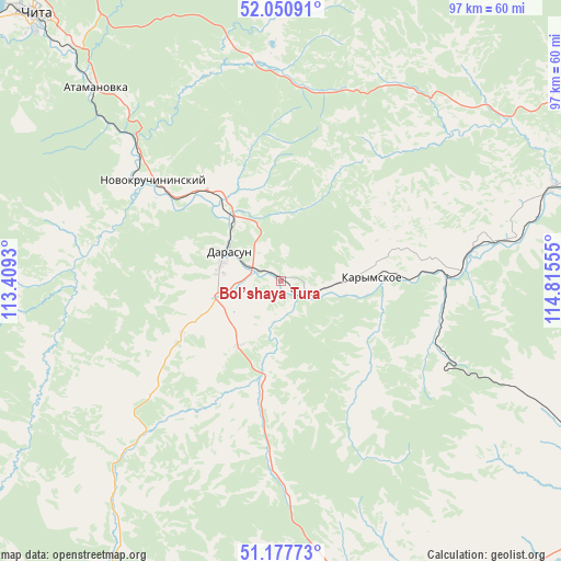
Bol’shaya Tura GPS coordinates[2]
51° 36' 59.112" North, 114° 6' 44.712" East
| Map corner | latitude | longitude |
|---|---|---|
| Upper-left | 52.05091°, | 113.4093° |
| Center: | 51.61642°, | 114.11242° |
| Lower-right: | 51.17773°, | 114.81555° |
| Map W x H: | 97.1×97.1 km | = 60.3×60.3mi |
| max Lat: | 73.50819° ⇑71.8% North |
| Bol’shaya Tura: | 51.61642° |
| min Lat: | ⇓28.2% South 41.28413° |
| min Long | Bol’shaya Tur | max Long |
| -179.12198° | 114.11242° | 179.35046° |
| W 92%⇐ | ⇒8% E |
Elevation
Elevation of Bol’shaya Tura is 597 m = 1959 ft, and this is 394.4 m = 1294 ft above average elevation for this country.
| Max E: |
2518 m = 8261 ft | 5.7% |
| Bol’shaya Tura | 597 m 1959 ft | |
| Avg. | 202.6 m = 665 ft | |
Min E: |
-28 m = -92 ft | 94.3% |
See also: Russia elevation on elevation.city.
Geographical zone
Bol’shaya Tura is located in North temperate zone (between Tropic of Cancer and the Arctic Circle). Distance of this North polar circle is 1662 km =1032.7 mi to North.| Distance of | km | miles | from Bol’shaya Tura |
|---|---|---|---|
| North Pole | 4267.9 | 2651.9 | to North |
| Arctic Circle | 1662 | 1032.7 | to North |
| Tropic Cancer | 3133.3 | 1946.9 | to South |
| Equator | 5739.2 | 3566.2 | to South |


Nearby cities:
15 places around Bol’shaya Tura: (largest is in red/bold)
• Aginskoye
64.3 km =40 mi,  153°
153°
• Atamanovka
48.2 km =30 mi,  316°
316°
• Chita
62.4 km =38.8 mi, 317°
• Darasun
10.6 km =6.6 mi,  296°
296°
• Domna
72.8 km =45.2 mi, 295°
• Drovyanaya
74.2 km =46.1 mi,  266°
266°
• Karymskoye
16.4 km =10.2 mi,  89°
89°
• Kurort-Darasun
53.9 km =33.5 mi,  210°
210°
• Makkaveyevo
19.1 km =11.9 mi, 322°
• Mogoytuy
66.9 km =41.6 mi,  123°
123°
• Novokruchininskiy
29.7 km =18.5 mi,  308°
308°
• Novoorlovsk
73.7 km =45.8 mi,  144°
144°
• Orlovskiy
81.9 km =50.9 mi, 142°
• Smolenka
71.5 km =44.4 mi, 323°
• Yablonovo
96.3 km =59.8 mi,  285°
285°
Sources, notices
• [Note1] Compared only with cities in Russia existing in our database
• [Src1] Map data: © OpenStreetMap contributors (CC-BY-SA)
• [Src2] Other city data from geonames.org with taken over terms of usage.
• [Src3] Geographical zone / Annual Mean Temperature by Robert A. Rohde @ Wikipedia
