Novoorlovsk geodata
Novoorlovsk (Transbaikal Territory) is a populated place; located in Russia in Asia/Chita (GMT+9) time zone. With population of 2,980 people, there are 3788 cities with bigger population in this country. Compared to other cities in Russia, 74.6% of cities are located further ↑North; 92.1% of cities are located further ←West and 96.7% of cities have lower elevation than Novoorlovsk. Note1
Administrative division(s):
- Level 1: Transbaikal Territory
- Level 2: Aginskiy Buryatskiy Okrug
- Level 3: Aginskiy Rayon


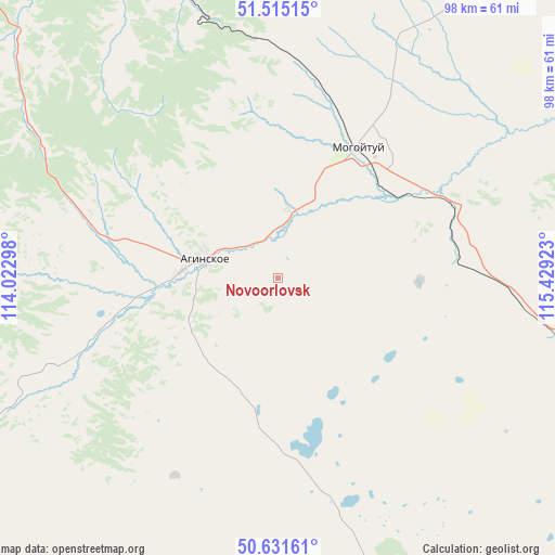
Novoorlovsk GPS coordinates[2]
51° 4' 31.764" North, 114° 43' 33.96" East
| Map corner | latitude | longitude |
|---|---|---|
| Upper-left | 51.51515°, | 114.02298° |
| Center: | 51.07549°, | 114.7261° |
| Lower-right: | 50.63161°, | 115.42923° |
| Map W x H: | 98.2×98.2 km | = 61×61mi |
| max Lat: | 73.50819° ⇑74.6% North |
| Novoorlovsk: | 51.07549° |
| min Lat: | ⇓25.4% South 41.28413° |
| min Long | Novoorlovsk | max Long |
| -179.12198° | 114.7261° | 179.35046° |
| W 92.1%⇐ | ⇒7.9% E |
Elevation
Elevation of Novoorlovsk is 748 m = 2454 ft, and this is 545.4 m = 1789 ft above average elevation for this country.
| Max E: |
2518 m = 8261 ft | 3.3% |
| Novoorlovsk | 748 m 2454 ft | |
| Avg. | 202.6 m = 665 ft | |
Min E: |
-28 m = -92 ft | 96.7% |
See also: Russia elevation on elevation.city.
Geographical zone
Novoorlovsk is located in North temperate zone (between Tropic of Cancer and the Arctic Circle). Distance of this North polar circle is 1722.1 km =1070.1 mi to North.| Distance of | km | miles | from Novoorlovsk |
|---|---|---|---|
| North Pole | 4328 | 2689.3 | to North |
| Arctic Circle | 1722.1 | 1070.1 | to North |
| Tropic Cancer | 3073.1 | 1909.5 | to South |
| Equator | 5679.1 | 3528.8 | to South |


Nearby cities:
15 places around Novoorlovsk: (largest is in red/bold)
• Aginskoye
14 km =8.7 mi,  281°
281°
• Bol’shaya Tura
73.7 km =45.8 mi,  324°
324°
• Budulan
57.9 km =36 mi,  167°
167°
• Darasun
83.3 km =51.8 mi, 321°
• Dul’durga
91.1 km =56.6 mi,  240°
240°
• Guney
63.5 km =39.5 mi,  190°
190°
• Karymskoye
65.6 km =40.8 mi,  336°
336°
• Kurort-Darasun
71.8 km =44.6 mi, 281°
• Makkaveyevo
92.8 km =57.7 mi, 324°
• Mogoytuy
26.7 km =16.6 mi,  29°
29°
• Nizhniy Tsasuchey
68.4 km =42.5 mi,  155°
155°
• Novokruchininskiy
102.7 km =63.8 mi, 320°
• Olovyannaya
60.4 km =37.5 mi,  103°
103°
• Orlovskiy
8.8 km =5.5 mi,  122°
122°
• Pervomayskiy
90.9 km =56.5 mi,  43°
43°
Sources, notices
• [Note1] Compared only with cities in Russia existing in our database
• [Src1] Map data: © OpenStreetMap contributors (CC-BY-SA)
• [Src2] Other city data from geonames.org with taken over terms of usage.
• [Src3] Geographical zone / Annual Mean Temperature by Robert A. Rohde @ Wikipedia
