Aginskoye geodata
Aginskoye (Transbaikal Territory) is a seat of a second-order administrative division; located in Russia in Asia/Chita (GMT+9) time zone. With population of 17,496 people, there are 975 cities with bigger population in this country. Compared to other cities in Russia, 74.5% of cities are located further ↑North; 92.1% of cities are located further ←West and 95.6% of cities have lower elevation than Aginskoye. Note1
Administrative division(s):
- Level 1: Transbaikal Territory
- Level 2: Aginskiy Buryatskiy Okrug
- Level 3: Aginskiy Rayon


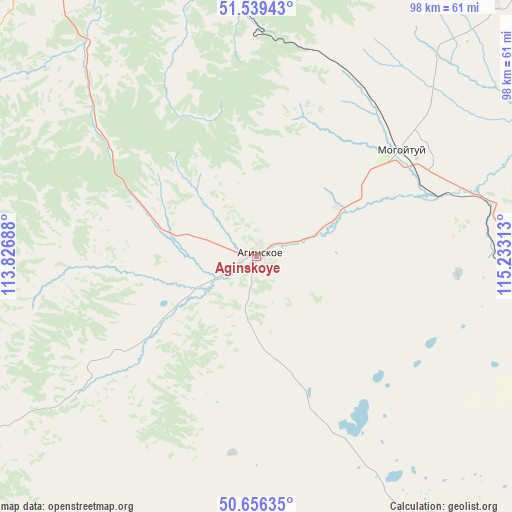
Aginskoye GPS coordinates[2]
51° 6' 0" North, 114° 31' 48" East
| Map corner | latitude | longitude |
|---|---|---|
| Upper-left | 51.53943°, | 113.82688° |
| Center: | 51.1°, | 114.53° |
| Lower-right: | 50.65635°, | 115.23313° |
| Map W x H: | 98.2×98.2 km | = 61×61mi |
| max Lat: | 73.50819° ⇑74.5% North |
| Aginskoye: | 51.1° |
| min Lat: | ⇓25.5% South 41.28413° |
| min Long | Aginskoye | max Long |
| -179.12198° | 114.53° | 179.35046° |
| W 92.1%⇐ | ⇒7.9% E |
Elevation
Elevation of Aginskoye is 675 m = 2215 ft, and this is 472.4 m = 1550 ft above average elevation for this country.
| Max E: |
2518 m = 8261 ft | 4.4% |
| Aginskoye | 675 m 2215 ft | |
| Avg. | 202.6 m = 665 ft | |
Min E: |
-28 m = -92 ft | 95.6% |
See also: Russia elevation on elevation.city.
Geographical zone
Aginskoye is located in North temperate zone (between Tropic of Cancer and the Arctic Circle). Distance of this North polar circle is 1719.4 km =1068.4 mi to North.| Distance of | km | miles | from Aginskoye |
|---|---|---|---|
| North Pole | 4325.3 | 2687.6 | to North |
| Arctic Circle | 1719.4 | 1068.4 | to North |
| Tropic Cancer | 3075.9 | 1911.3 | to South |
| Equator | 5681.8 | 3530.5 | to South |


Nearby cities:
15 places around Aginskoye: (largest is in red/bold)
• Bol’shaya Tura
64.3 km =40 mi,  333°
333°
• Budulan
64.7 km =40.2 mi,  156°
156°
• Darasun
73.2 km =45.5 mi, 328°
• Dul’durga
80.9 km =50.3 mi,  234°
234°
• Guney
65.2 km =40.5 mi,  178°
178°
• Karymskoye
58.8 km =36.5 mi,  347°
347°
• Kurort-Darasun
57.8 km =35.9 mi,  280°
280°
• Makkaveyevo
83.2 km =51.7 mi, 330°
• Mogoytuy
33.8 km =21 mi,  52°
52°
• Nizhniy Tsasuchey
77.5 km =48.2 mi,  146°
146°
• Novokruchininskiy
92.2 km =57.3 mi, 325°
• Novoorlovsk
14 km =8.7 mi,  101°
101°
• Olovyannaya
74.4 km =46.2 mi, 102°
• Orlovskiy
22.5 km =14 mi,  109°
109°
• Pervomayskiy
99 km =61.5 mi, 50°
Sources, notices
• [Note1] Compared only with cities in Russia existing in our database
• [Src1] Map data: © OpenStreetMap contributors (CC-BY-SA)
• [Src2] Other city data from geonames.org with taken over terms of usage.
• [Src3] Geographical zone / Annual Mean Temperature by Robert A. Rohde @ Wikipedia
