Karymskoye geodata
Karymskoye (Transbaikal Territory) is a populated place; located in Russia in Asia/Chita (GMT+9) time zone. With population of 11,901 people, there are 1291 cities with bigger population in this country. Compared to other cities in Russia, 71.8% of cities are located further ↑North; 92.1% of cities are located further ←West and 94.2% of cities have lower elevation than Karymskoye. Note1


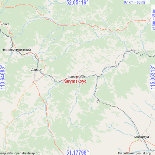
Karymskoye GPS coordinates[2]
51° 37' 0.012" North, 114° 21' 0" East
| Map corner | latitude | longitude |
|---|---|---|
| Upper-left | 52.05116°, | 113.64688° |
| Center: | 51.61667°, | 114.35° |
| Lower-right: | 51.17798°, | 115.05313° |
| Map W x H: | 97.1×97.1 km | = 60.3×60.3mi |
| max Lat: | 73.50819° ⇑71.8% North |
| Karymskoye: | 51.61667° |
| min Lat: | ⇓28.2% South 41.28413° |
| min Long | Karymskoye | max Long |
| -179.12198° | 114.35° | 179.35046° |
| W 92.1%⇐ | ⇒7.9% E |
Elevation
Elevation of Karymskoye is 594 m = 1949 ft, and this is 391.4 m = 1284 ft above average elevation for this country.
| Max E: |
2518 m = 8261 ft | 5.8% |
| Karymskoye | 594 m 1949 ft | |
| Avg. | 202.6 m = 665 ft | |
Min E: |
-28 m = -92 ft | 94.2% |
See also: Russia elevation on elevation.city.
Geographical zone
Karymskoye is located in North temperate zone (between Tropic of Cancer and the Arctic Circle). Distance of this North polar circle is 1661.9 km =1032.7 mi to North.| Distance of | km | miles | from Karymskoye |
|---|---|---|---|
| North Pole | 4267.8 | 2651.9 | to North |
| Arctic Circle | 1661.9 | 1032.7 | to North |
| Tropic Cancer | 3133.3 | 1946.9 | to South |
| Equator | 5739.2 | 3566.2 | to South |


Nearby cities:
15 places around Karymskoye: (largest is in red/bold)
• Aginskoye
58.8 km =36.5 mi,  167°
167°
• Atamanovka
60.6 km =37.7 mi,  305°
305°
• Bol’shaya Tura
16.4 km =10.2 mi,  269°
269°
• Chita
74.4 km =46.2 mi, 308°
• Darasun
26.3 km =16.3 mi,  280°
280°
• Domna
87.8 km =54.6 mi,  290°
290°
• Drovyanaya
90.5 km =56.2 mi, 267°
• Kurort-Darasun
64 km =39.8 mi,  223°
223°
• Makkaveyevo
31.8 km =19.8 mi,  298°
298°
• Mogoytuy
54 km =33.6 mi,  133°
133°
• Novokruchininskiy
43.7 km =27.2 mi, 295°
• Novoorlovsk
65.6 km =40.8 mi,  156°
156°
• Orlovskiy
73 km =45.4 mi,  152°
152°
• Pervomayskiy
88.2 km =54.8 mi,  86°
86°
• Smolenka
82.2 km =51.1 mi, 314°
Sources, notices
• [Note1] Compared only with cities in Russia existing in our database
• [Src1] Map data: © OpenStreetMap contributors (CC-BY-SA)
• [Src2] Other city data from geonames.org with taken over terms of usage.
• [Src3] Geographical zone / Annual Mean Temperature by Robert A. Rohde @ Wikipedia
