Posol’skoye geodata
Posol’skoye (Buryatiya Republic) is a populated place; located in Russia in Asia/Irkutsk (GMT+8) time zone. With population of 782 people, there are 4769 cities with bigger population in this country. Compared to other cities in Russia, 69.1% of cities are located further ↑North; 90% of cities are located further ←West and 89.9% of cities have lower elevation than Posol’skoye. Note1


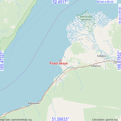
Posol’skoye GPS coordinates[2]
52° 1' 15.996" North, 106° 10' 35.004" East
| Map corner | latitude | longitude |
|---|---|---|
| Upper-left | 52.4517°, | 105.47327° |
| Center: | 52.02111°, | 106.17639° |
| Lower-right: | 51.58633°, | 106.87952° |
| Map W x H: | 96.2×96.2 km | = 59.8×59.8mi |
| max Lat: | 73.50819° ⇑69.1% North |
| Posol’skoye: | 52.02111° |
| min Lat: | ⇓30.9% South 41.28413° |
| min Long | Posol’skoye | max Long |
| -179.12198° | 106.17639° | 179.35046° |
| W 90%⇐ | ⇒10% E |
Elevation
Elevation of Posol’skoye is 449 m = 1473 ft, and this is 246.4 m = 808 ft above average elevation for this country.
| Max E: |
2518 m = 8261 ft | 10.1% |
| Posol’skoye | 449 m 1473 ft | |
| Avg. | 202.6 m = 665 ft | |
Min E: |
-28 m = -92 ft | 89.9% |
See also: Russia elevation on elevation.city.
Geographical zone
Posol’skoye is located in North temperate zone (between Tropic of Cancer and the Arctic Circle). Distance of this North polar circle is 1617 km =1004.8 mi to North.| Distance of | km | miles | from Posol’skoye |
|---|---|---|---|
| North Pole | 4222.9 | 2624 | to North |
| Arctic Circle | 1617 | 1004.8 | to North |
| Tropic Cancer | 3178.3 | 1974.9 | to South |
| Equator | 5784.2 | 3594.1 | to South |


Nearby cities:
15 places around Posol’skoye: (largest is in red/bold)
• Babushkin
40.5 km =25.2 mi,  211°
211°
• Bol’shoye Goloustnoye
52.7 km =32.7 mi,  272°
272°
• Bugul’deyka
58.8 km =36.5 mi,  353°
353°
• Gusinoozyorsk
85 km =52.8 mi,  164°
164°
• Il’inka
75.6 km =47 mi,  81°
81°
• Istok
9.6 km =6 mi,  30°
30°
• Ivolginsk
81.8 km =50.8 mi,  111°
111°
• Kabansk
32.7 km =20.3 mi, 84°
• Listvyanka
91.5 km =56.9 mi,  258°
258°
• Sokol
90.4 km =56.2 mi, 105°
• Sotnikovo
90.8 km =56.4 mi,  99°
99°
• Tankhoy
88.8 km =55.2 mi,  234°
234°
• Tataurovo
87.4 km =54.3 mi, 81°
• Verkhnyaya Ivolga
76.1 km =47.3 mi, 113°
• Yelantsy
88.3 km =54.9 mi,  10°
10°
Sources, notices
• [Note1] Compared only with cities in Russia existing in our database
• [Src1] Map data: © OpenStreetMap contributors (CC-BY-SA)
• [Src2] Other city data from geonames.org with taken over terms of usage.
• [Src3] Geographical zone / Annual Mean Temperature by Robert A. Rohde @ Wikipedia
