Bugul’deyka geodata
Bugul’deyka (Irkutsk Oblast) is a populated place; located in Russia in Asia/Irkutsk (GMT+8) time zone. With population of 931 people, there are 4683 cities with bigger population in this country. Compared to other cities in Russia, 65.9% of cities are located further ↑North; 90% of cities are located further ←West and 91.2% of cities have lower elevation than Bugul’deyka. Note1


Bugul’deyka GPS coordinates[2]
52° 32' 45.996" North, 106° 4' 23.016" East
| Map corner | latitude | longitude |
|---|---|---|
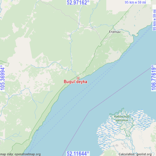
| Upper-left | 52.97162°, | 105.36994° |
| Center: | 52.54611°, | 106.07306° |
| Lower-right: | 52.11644°, | 106.77619° |
| Map W x H: | 95.1×95.1 km | = 59.1×59.1mi |
| max Lat: | 73.50819° ⇑65.9% North |
| Bugul’deyka: | 52.54611° |
| min Lat: | ⇓34.1% South 41.28413° |
| min Long | Bugul’deyka | max Long |
| -179.12198° | 106.07306° | 179.35046° |
| W 90%⇐ | ⇒10% E |
Elevation
Elevation of Bugul’deyka is 480 m = 1575 ft, and this is 277.4 m = 910 ft above average elevation for this country.
| Max E: |
2518 m = 8261 ft | 8.8% |
| Bugul’deyka | 480 m 1575 ft | |
| Avg. | 202.6 m = 665 ft | |
Min E: |
-28 m = -92 ft | 91.2% |
See also: Russia elevation on elevation.city.
Geographical zone
Bugul’deyka is located in North temperate zone (between Tropic of Cancer and the Arctic Circle). Distance of this North polar circle is 1558.6 km =968.5 mi to North.| Distance of | km | miles | from Bugul’deyka |
|---|---|---|---|
| North Pole | 4164.5 | 2587.7 | to North |
| Arctic Circle | 1558.6 | 968.5 | to North |
| Tropic Cancer | 3236.7 | 2011.2 | to South |
| Equator | 5842.6 | 3630.4 | to South |


Nearby cities:
15 places around Bugul’deyka: (largest is in red/bold)
• Babushkin
93.8 km =58.3 mi,  188°
188°
• Bayanday
69 km =42.9 mi,  326°
326°
• Bol’shaya Rechka
112.5 km =69.9 mi,  234°
234°
• Bol’shoye Goloustnoye
72.3 km =44.9 mi,  218°
218°
• Il’inka
94.2 km =58.5 mi,  120°
120°
• Istok
51.5 km =32 mi,  166°
166°
• Kabansk
67.9 km =42.2 mi,  144°
144°
• Khuzhir
111.4 km =69.2 mi,  49°
49°
• Listvyanka
112.5 km =69.9 mi, 226°
• Manzurka
104.5 km =64.9 mi,  359°
359°
• Oyëk
109.4 km =68 mi,  272°
272°
• Posol’skoye
58.8 km =36.5 mi, 173°
• Tataurovo
103.2 km =64.1 mi, 115°
• Ust’-Ordynskiy
93.7 km =58.2 mi,  287°
287°
• Yelantsy
36.3 km =22.6 mi,  38°
38°
Sources, notices
• [Note1] Compared only with cities in Russia existing in our database
• [Src1] Map data: © OpenStreetMap contributors (CC-BY-SA)
• [Src2] Other city data from geonames.org with taken over terms of usage.
• [Src3] Geographical zone / Annual Mean Temperature by Robert A. Rohde @ Wikipedia
