Yagodnoye geodata
Yagodnoye (Magadan Oblast) is a populated place; located in Russia in Asia/Magadan (GMT+11) time zone. With population of 3,921 people, there are 3158 cities with bigger population in this country. Compared to other cities in Russia, 95.7% of cities are located further ↓South; 99.1% of cities are located further ←West and 91.2% of cities have lower elevation than Yagodnoye. Note1


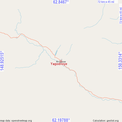
Yagodnoye GPS coordinates[2]
62° 31' 26.616" North, 149° 37' 41.772" East
| Map corner | latitude | longitude |
|---|---|---|
| Upper-left | 62.8467°, | 148.92515° |
| Center: | 62.52406°, | 149.62827° |
| Lower-right: | 62.19788°, | 150.3314° |
| Map W x H: | 72.1×72.1 km | = 44.8×44.8mi |
| max Lat: | 73.50819° ⇑4.3% North |
| Yagodnoye: | 62.52406° |
| min Lat: | ⇓95.7% South 41.28413° |
| min Long | Yagodnoye | max Long |
| -179.12198° | 149.62827° | 179.35046° |
| W 99.1%⇐ | ⇒0.90000000000001% E |
Elevation
Elevation of Yagodnoye is 480 m = 1575 ft, and this is 277.4 m = 910 ft above average elevation for this country.
| Max E: |
2518 m = 8261 ft | 8.8% |
| Yagodnoye | 480 m 1575 ft | |
| Avg. | 202.6 m = 665 ft | |
Min E: |
-28 m = -92 ft | 91.2% |
See also: Russia elevation on elevation.city.
Geographical zone
Yagodnoye is located in North temperate zone (between Tropic of Cancer and the Arctic Circle). Distance of this North polar circle is 449.2 km =279.1 mi to North.| Distance of | km | miles | from Yagodnoye |
|---|---|---|---|
| North Pole | 3055 | 1898.3 | to North |
| Arctic Circle | 449.2 | 279.1 | to North |
| Tropic Cancer | 4346.1 | 2700.5 | to South |
| Equator | 6952 | 4319.8 | to South |


Nearby cities:
15 places around Yagodnoye: (largest is in red/bold)
• Atka
219.7 km =136.5 mi,  148°
148°
• Burkhala
29.8 km =18.5 mi,  297°
297°
• Debin
61.5 km =38.2 mi,  109°
109°
• Kadykchan
146.6 km =91.1 mi,  294°
294°
• Karamken
269 km =167.1 mi,  163°
163°
• Kholodnyy
90.2 km =56 mi,  283°
283°
• Myaundzha
137.3 km =85.3 mi, 295°
• Orotukan
109.2 km =67.9 mi, 105°
• Seymchan
147.9 km =91.9 mi,  72°
72°
• Shirokiy
101.3 km =62.9 mi,  307°
307°
• Sinegor'ye
67 km =41.6 mi,  136°
136°
• Spornoye
78.7 km =48.9 mi,  104°
104°
• Susuman
80.5 km =50 mi, 290°
• Talaya
208.3 km =129.4 mi,  127°
127°
• Ust’-Omchug
154.6 km =96.1 mi,  179°
179°
Sources, notices
• [Note1] Compared only with cities in Russia existing in our database
• [Src1] Map data: © OpenStreetMap contributors (CC-BY-SA)
• [Src2] Other city data from geonames.org with taken over terms of usage.
• [Src3] Geographical zone / Annual Mean Temperature by Robert A. Rohde @ Wikipedia
